Darwen by Epworth Street
Darwen by Epworth Street is a bus stop in Blackburn with Darwen, England. Darwen by Epworth Street is situated nearby to Bolton Road United Reformed Church, as well as near St Barnabas’ Church, Darwen.| Tap on a place to explore it |
Places of Interest Nearby
Highlights include St Barnabas’ Church, Darwen and Darwen Cemetery.
St Barnabas’ Church, Darwen
Church
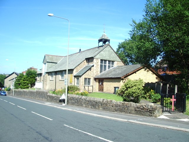
Photo: Alexander P Kapp, CC BY-SA 2.0.
St Barnabas' Church is on Watery Lane, Darwen, Lancashire, England. It is an active Anglican parish church in the deanery of Blackburn with Darwen, the archdeaconry of Blackburn, and the diocese of Blackburn. St Barnabas’ Church, Darwen is situated 1,100 feet southeast of Darwen by Epworth Street.
Darwen Cemetery
Cemetery

Photo: Plucas58, CC BY-SA 4.0.
Darwen Cemetery is a public cemetery in the town of Darwen, Lancashire, England, which lies on both sides of Bolton Road with views across Darwen to the hills beyond. Darwen Cemetery is situated 2,200 feet south of Darwen by Epworth Street.
Darwen railway station
Railway station
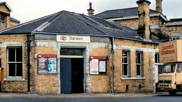
Photo: Albert Bridge, CC BY-SA 2.0.
Darwen railway station serves Darwen, a town in Lancashire, England. It was opened in 1847 by the Bolton, Blackburn, Clitheroe & West Yorkshire Railway, which was subsequently taken over by the Lancashire and Yorkshire Railway twelve years later. Darwen railway station is situated 1 mile north of Darwen by Epworth Street.
Places in the Area
Nearby places include Darwen and Hoddlesden.
Darwen
Town
Darwen is a market town and civil parish in the Blackburn with Darwen borough in Lancashire, England. The residents of the town are known as "Darreners".
Hoddlesden
Village
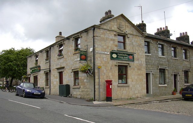
Photo: robert wade, CC BY-SA 2.0.
Hoddlesden is a village in the borough of Blackburn with Darwen, in Lancashire, England. The village population at the 2011 census was 1,239. It is in the borough's East Rural ward, and is situated east of Darwen.
Lower Darwen
Village

Photo: David Dixon, CC BY-SA 2.0.
Lower Darwen is a village in the unitary borough of Blackburn with Darwen, contiguous with the town of Darwen, in the county of Lancashire. It is located between the towns of Blackburn and Darwen. Lower Darwen is situated 2½ miles north of Darwen by Epworth Street.
Darwen by Epworth Street
- Type: Bus stop
- Category: transportation
- Location: Blackburn with Darwen, England, United Kingdom, Britain and Ireland, Europe
- View on OpenStreetMap
Latitude
53.68425° or 53° 41′ 3″ northLongitude
-2.4612° or 2° 27′ 40″ westOpen location code
9C5VMGMQ+PGOpenStreetMap ID
node 12825853349OpenStreetMap feature
highway=bus_stopOpenStreetMap feature
public_transport=platform
This page is based on OpenStreetMap, Wikidata, and Wikimedia Commons.
We’d love your help improving our open data sources. Thank you for contributing.
Satellite Map
Discover Darwen by Epworth Street from above in high-definition satellite imagery.
Notable Places Nearby
Highlights include Bolton Road United Reformed Church and Ashleigh Primary School.
Nearby Places
Explore places such as Darwen adj Ashleigh Street and Darwen by Mayfield Flats.
England: Must-Visit Destinations
Delve into London, Manchester, Sheffield, and Leeds.
Curious Bus Stops to Discover
Uncover intriguing bus stops from every corner of the globe.
About Mapcarta. Data © OpenStreetMap contributors and available under the Open Database License". Text is available under the CC BY-SA 4.0 license, except for photos, directions, and the map. Photo: sidibousaid, CC BY 2.0.