ASB Rettungswache Lüdersburg
ASB Rettungswache Lüdersburg is a public building in Lüdersburg, Lüneburg, Lower Saxony. ASB Rettungswache Lüdersburg is situated nearby to the cemetery Friedhof Gemeinde Lüdersburg, as well as near the fire station Freiwillige Feuerwehr Lüdersburg.| Tap on a place to explore it |
Places of Interest Nearby
Highlights include Lüdersburg château and St. Peter- und Paul-Kirche.
Lüdersburg château
Castle

Photo: Castritus, CC BY-SA 4.0.
Lüdersburg château is a castle, which is situated 350 metres southwest of ASB Rettungswache Lüdersburg.
St. Peter- und Paul-Kirche
Church

Photo: Laben, CC BY-SA 3.0.
St. Peter- und Paul-Kirche is a church, which is situated 300 metres southwest of ASB Rettungswache Lüdersburg.
Echem station
Railway stop

Photo: Warrel040, CC BY-SA 4.0.
Echem station is a railway stop, which is situated 3 km northwest of ASB Rettungswache Lüdersburg.
Places in the Area
Nearby places include Rosenthal and Hohnstorf.
Rosenthal
Village

Photo: Raboe001, CC BY-SA 3.0 de.
Rosenthal is a village, which is situated 4 km east of ASB Rettungswache Lüdersburg.
Hohnstorf
Village
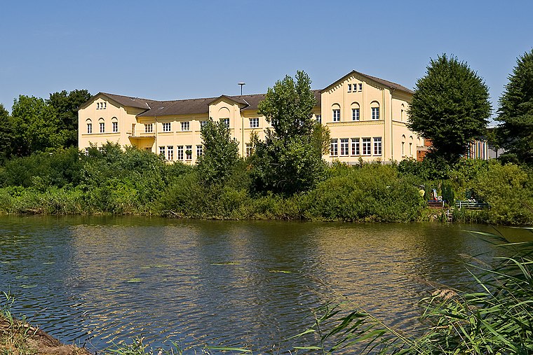
Photo: Torsten Bätge, CC BY-SA 3.0.
Hohnstorf is a municipality in the district of Lüneburg, in Lower Saxony, Germany. Hohnstorf is situated 5 km north of ASB Rettungswache Lüdersburg.
Lauenburg
Town

Photo: Wikimedia, CC BY-SA 3.0.
Lauenburg, or Lauenburg an der Elbe, is a town in the state of Schleswig-Holstein, Germany. It is situated on the northern bank of the river Elbe, east of Hamburg. Lauenburg is situated 6 km north of ASB Rettungswache Lüdersburg.
ASB Rettungswache Lüdersburg
- Type: Public building
- Categories: building and government building
- Location: Lüdersburg, Lüneburg, Lower Saxony, Germany, Central Europe, Europe
- View on OpenStreetMap
Latitude
53.32295° or 53° 19′ 23″ northLongitude
10.57675° or 10° 34′ 36″ eastBrand
Arbeiter-Samariter-BundOperator
ASB-Kreisverband LüneburgOpen location code
9F5G8HFG+5MOpenStreetMap ID
node 12840608003OpenStreetMap feature
building=civic
This page is based on OpenStreetMap, Wikidata, and Wikimedia Commons.
We’d love your help improving our open data sources. Thank you for contributing.
Satellite Map
Discover ASB Rettungswache Lüdersburg from above in high-definition satellite imagery.
Notable Places Nearby
Highlights include Friedhof Gemeinde Lüdersburg and Gemeinde Lüdersburg.
Nearby Places
Explore places such as Schmiede and Rauchkate.
Lower Saxony: Must-Visit Destinations
Delve into Hanover, Göttingen, Brunswick, and Wolfsburg.
Curious Public Buildings to Discover
Uncover intriguing public buildings from every corner of the globe.
About Mapcarta. Data © OpenStreetMap contributors and available under the Open Database License". Text is available under the CC BY-SA 4.0 license, except for photos, directions, and the map. Photo: Danapit, CC BY-SA 3.0.