Harlowes
Harlowes is a pub in Sandwich, Dover District, England which is located on Cattle Market. Harlowes is situated nearby to the movie theater The Empire Cinema, as well as near United Reformed Church.| Tap on a place to explore it |
Places of Interest Nearby
Highlights include St Peter’s Church, Sandwich and St Mary’s Church.
St Peter’s Church, Sandwich
Church

Photo: China Crisis, CC BY-SA 3.0.
St Peter's Church is a redundant Anglican church in Sandwich, Kent, England. It is recorded in the National Heritage List for England as a designated Grade I listed building, and is under the care of the Churches Conservation Trust. St Peter’s Church, Sandwich is situated 440 feet east of Harlowes.
St Mary’s Church
Church
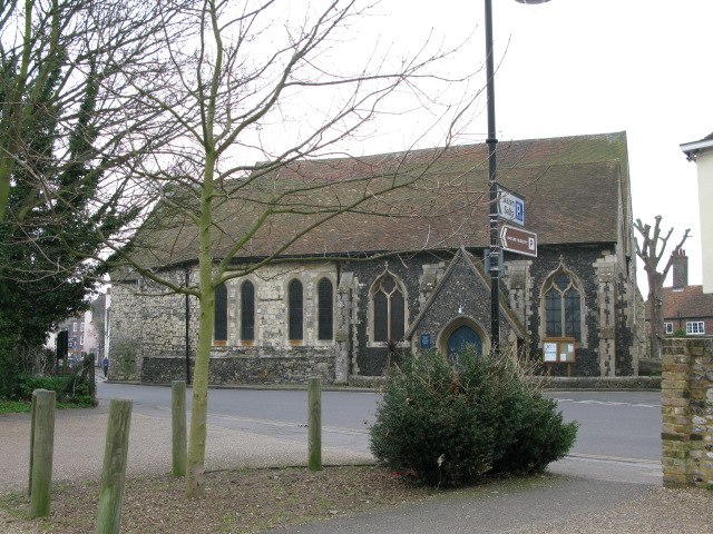
Photo: Nick Smith, CC BY-SA 2.0.
St. Mary's Church is a redundant Anglican church in the town of Sandwich, Kent, England. It is recorded in the National Heritage List for England as a designated Grade I listed building, and is under the care of the Churches Conservation Trust. St Mary’s Church is situated 720 feet north of Harlowes.

Places in the Area
Nearby places include Worth and Richborough.
Worth
Village

Photo: Nick Smith, CC BY-SA 2.0.
Worth is a village and civil parish in the Dover District of Kent, England, situated 2 kilometres south of Sandwich. It has two public houses, a church, and a school.
Richborough
Village

Photo: Val Vannet, CC BY-SA 2.0.
Richborough is a settlement north of Sandwich on the east coast of the county of Kent, England. Richborough lies close to the Isle of Thanet. The population of the settlement is included in the civil parish of Ash.
Marshborough
Hamlet

Photo: Nick Smith, CC BY-SA 2.0.
Marshborough is a small hamlet immediately adjacent to Woodnesborough in East Kent, England. Marshborough is situated 1½ miles west of Harlowes.
Harlowes
- Type: Pub
- Address: 2 Cattle Market, Sandwich, CT13 9AF
- Location: Sandwich, Dover District, Kent, South East England, England, United Kingdom, Britain and Ireland, Europe
- View on OpenStreetMap
Latitude
51.27531° or 51° 16′ 31″ northLongitude
1.33848° or 1° 20′ 19″ eastOpen location code
9F3378GQ+49OpenStreetMap ID
node 12864961251OpenStreetMap feature
amenity=pub
This page is based on OpenStreetMap, Wikidata, and Wikimedia Commons.
We’d love your help improving our open data sources. Thank you for contributing.
Satellite Map
Discover Harlowes from above in high-definition satellite imagery.
Notable Places Nearby
Highlights include The Empire Cinema and United Reformed Church.
Nearby Places
Explore places such as Sandwich Cars and Guildhall.
Kent: Must-Visit Destinations
Delve into Canterbury, Dover, Maidstone, and Rochester.
Curious Pubs to Discover
Uncover intriguing pubs from every corner of the globe.
About Mapcarta. Data © OpenStreetMap contributors and available under the Open Database License". Text is available under the CC BY-SA 4.0 license, except for photos, directions, and the map. Photo: Traveler100, CC BY-SA 4.0.