Chrome Mustang
Chrome Mustang is a work of art in Sacramento County, Sacramento Valley, California. Chrome Mustang is situated nearby to the hospital Valley Recovery Center of California, as well as near Campus Commons Pond.| Tap on a place to explore it |
Places of Interest Nearby
Highlights include University Arboretum at California State University, Sacramento and Guy A West Bridge.
University Arboretum at California State University, Sacramento
Garden

Photo: DevinCook, Public domain.
The University Arboretum is the arboretum and botanic garden of the California State University, Sacramento at 6000 J Street, Sacramento, California. Founded in 1945 on what used to be a pear orchard and hop ranch, the arboretum was originally named the Charles M. University Arboretum at California State University, Sacramento is situated 1 mile southwest of Chrome Mustang.
Guy A West Bridge
Bridge

Photo: Matthew Fern, CC BY-SA 2.0.
The Guy West Bridge is a suspension bridge for pedestrian and bicycle traffic spanning the American River in Sacramento in Sacramento County, California, linking the campus of California State University, Sacramento with the neighboring Campus Commons student housing development. Guy A West Bridge is situated 3,900 feet south of Chrome Mustang.
Hornet Stadium
Pitch
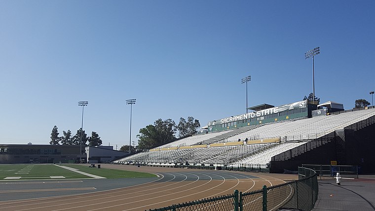
Photo: Spatms, CC BY-SA 4.0.
Fred Anderson Field at Hornet Stadium is a 21,195-seat college football and track stadium on the campus of California State University, Sacramento. it is the home field of the Sacramento State Hornets of the Big Sky Conference. Hornet Stadium is situated 1¼ miles south of Chrome Mustang.
Places in the Area
Nearby places include Ben Ali and Arden-Arcade.
Ben Ali
Neighborhood
Ben Ali is a neighborhood located within the city of Sacramento, California, United States. According to The Ben Ali Community Association, the boundaries of the neighborhood are: The Ben Ali community was named for James Ben Ali Haggin who owned much of the ranch later subdivided into these streets as well as adjacent neighborhoods. Ben Ali is situated 3 miles north of Chrome Mustang.
Arden-Arcade
Suburb
Arden-Arcade is a census-designated place in Sacramento County, California, United States. The population was 94,659 at the 2020 census, making it the second most populous census-designated place in California. Arden-Arcade is situated 3 miles northeast of Chrome Mustang.
Oak Park
Suburb
Oak Park is a neighborhood in Sacramento, California. The McGeorge School of Law, University of the Pacific Sacramento Campus, Sacramento High School, and Christian Brothers High School are located in this neighborhood. Oak Park is situated 3 miles southwest of Chrome Mustang.
Chrome Mustang
- Type: Work of art
- Artwork type: sculpture
- Category: tourism
- Location: Sacramento County, Sacramento Valley, California, United States, North America
- View on OpenStreetMap
Latitude
38.57259° or 38° 34′ 21″ northLongitude
-121.41647° or 121° 24′ 59″ westOpen location code
84CWHHFM+2COpenStreetMap ID
node 12881730083OpenStreetMap feature
tourism=artworkOpenStreetMap attribute
artwork_type=sculpture
This page is based on OpenStreetMap, Wikidata, and Wikimedia Commons.
We’d love your help improving our open data sources. Thank you for contributing.
Satellite Map
Discover Chrome Mustang from above in high-definition satellite imagery.
Notable Places Nearby
Highlights include Valley Recovery Center of California and Campus Commons Pond.
Nearby Places
Explore places such as Cold Stone Creamery and Tasty Dumpling.
Sacramento County: Must-Visit Destinations
Delve into Sacramento, Elk Grove, Folsom, and Citrus Heights.
Curious Work Of Arts to Discover
Uncover intriguing work of arts from every corner of the globe.
About Mapcarta. Data © OpenStreetMap contributors and available under the Open Database License". Text is available under the CC BY-SA 4.0 license, except for photos, directions, and the map. Photo: J.smith, CC BY-SA 3.0.