Udyan Ganpathi Temple
Udyan Ganpathi Temple is a Hindu temple in Mumbai, Maharashtra. Udyan Ganpathi Temple is situated nearby to the Hindu temple Kaali Maa Temple, as well as near the museum Samyukta Maharashtra Daalan.| Tap on a place to explore it |
Places of Interest Nearby
Highlights include Shivaji Park and Chaitya Bhoomi.
Shivaji Park
Park

Photo: Sumeet Rege, CC BY-SA 4.0.
Shivaji Park, officially Chhatrapati Shivaji Maharaj Park, is a public park situated in Dadar, Mumbai. It is the largest park in the island city. Similar but bigger in size to Azad Maidan and August Kranti Maidan, it is of historical and cultural value because of the political and social gatherings it has witnessed, both in pre- and post-independence Mumbai. Shivaji Park is situated 110 metres southeast of Udyan Ganpathi Temple.
Chaitya Bhoomi
Monument

Photo: संदेश हिवाळे, CC BY-SA 4.0.
Chaitya Bhoomi, also written as Chaityabhoomi, is a Buddhist chaitya and the cremation place of B. R. Ambedkar, the architect of the Indian Constitution and the revived Buddhism in India. Chaitya Bhoomi is situated 490 metres southwest of Udyan Ganpathi Temple.
Matunga Road railway station
Railway station

Photo: Superfast1111, CC BY-SA 4.0.
Matunga Road railway station is on the Western Line of the Mumbai Suburban Railway network in Maharashtra. It offers access to Matunga and Shivaji Park areas of Mumbai. Matunga Road railway station is situated 1 km east of Udyan Ganpathi Temple.
Places in the Area
Nearby places include Mumbai and Hindu Colony.
Mumbai

Photo: Anunandusg, CC BY-SA 3.0.
Mumbai, earlier known as Bombay, is the largest city in India and the capital of the state Maharashtra. A cosmopolitan metropolis, Mumbai was built on seven islands on the Konkan coastline which over time were joined to form the island city of Bombay.
Hindu Colony
Locality
Hindu Colony is an old locality situated in the Dadar area of Mumbai, India. The locality falls in between Dadar and Matunga on the east side of the Central Railway Line.
Mahim
Suburb
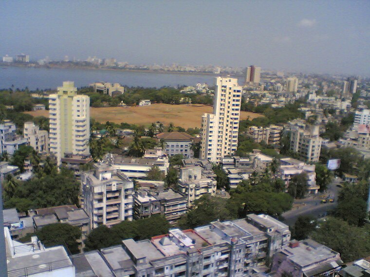
Photo: Mehulsg, CC BY-SA 3.0.
Mahim is a neighbourhood in Mumbai, Maharashtra, India. The Mahim Junction railway station on the Western Railway and Harbour Railway of the Mumbai Suburban Railway network is the last station of the city, as neighboring Bandra is part of Mumbai Suburb.
Udyan Ganpathi Temple
- Type: Hindu temple
- Categories: place of worship and religion
- Location: Mumbai, Mumbai District, Maharashtra, Western India, India, South Asia, Asia
- View on OpenStreetMap
Latitude
19.02787° or 19° 1′ 40″ northLongitude
72.83739° or 72° 50′ 15″ eastOpen location code
7JFJ2RHP+4XOpenStreetMap ID
node 12895989272OpenStreetMap feature
amenity=place_of_worship
This page is based on OpenStreetMap, Wikidata, and Wikimedia Commons.
We’d love your help improving our open data sources. Thank you for contributing.
Satellite Map
Discover Udyan Ganpathi Temple from above in high-definition satellite imagery.
Notable Places Nearby
Highlights include Kaali Maa Temple and Samyukta Maharashtra Daalan.
Nearby Places
Explore places such as Chhatrapati Shivaji Maharaj and Swatantryaveer Vinayak Damodar Savarka Statue.
Maharashtra: Must-Visit Destinations
Delve into Mumbai, Pune, Nagpur, and Nashik.
Curious Hindu Temples to Discover
Uncover intriguing Hindu temples from every corner of the globe.
About Mapcarta. Data © OpenStreetMap contributors and available under the Open Database License". Text is available under the CC BY-SA 4.0 license, except for photos, directions, and the map. Photo: Mangeshjadhav, CC BY-SA 3.0.