La Poignée de Cerises
La Poignée de Cerises is a clothing store in Arpajon, Arrondissement of Palaiseau, Île-de-France. La Poignée de Cerises is situated nearby to the art gallery Elza, as well as near the church Église Saint-Clément d’Arpajon.| Tap on a place to explore it |
Places of Interest Nearby
Highlights include Église Saint-Clément d’Arpajon and Town hall.
Église Saint-Clément d’Arpajon
Church
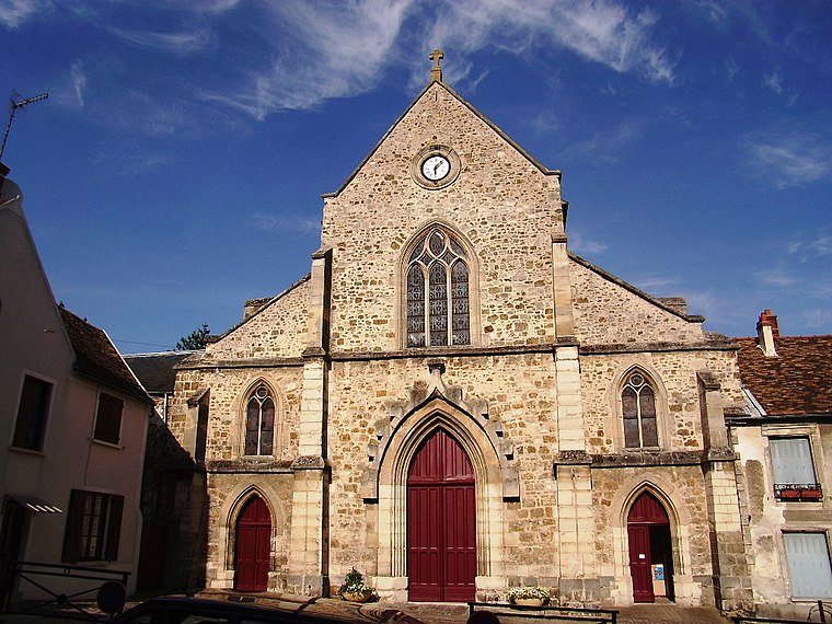
Photo: Cyrilb1881, CC BY-SA 3.0.
Église Saint-Clément d’Arpajon is a church.
Town hall
Town hall

Photo: GFreihalter, CC BY-SA 3.0.
Town hall is situated 230 metres south of La Poignée de Cerises.
Arpajon
Railway station

Photo: Cyrilb1881, CC BY-SA 3.0.
Arpajon is a railway station, which is situated 1 km southwest of La Poignée de Cerises.
Places in the Area
Nearby places include Arpajon and Saint-Germain-lès-Arpajon.
Arpajon
Town

Photo: Cyrilb1881, CC BY-SA 3.0.
Arpajon is a commune in the Essonne department in the Île-de-France region of northern France. The commune has been awarded three flowers by the National Council of Towns and Villages in Bloom in the Competition of cities and villages in Bloom.
Saint-Germain-lès-Arpajon
Village

Photo: Squallinou, CC BY-SA 3.0.
Saint-Germain-lès-Arpajon is a commune in the Essonne department. It is a suburb of Paris located 30 km south of Paris via the N20, and 20 km north of Étampes.
La Norville
Village

Photo: JC Allin, CC BY-SA 3.0.
La Norville is a commune in the Essonne department in Île-de-France in northern France.
La Poignée de Cerises
- Type: Clothing store
- Category: shop
- Location: Arpajon, Arrondissement of Palaiseau, Essonne, Île-de-France, France, Europe
- View on OpenStreetMap
Latitude
48.59219° or 48° 35′ 32″ northLongitude
2.24727° or 2° 14′ 50″ eastOpen location code
8FW4H6RW+VWOpenStreetMap ID
node 12897983145OpenStreetMap feature
shop=clothes
This page is based on OpenStreetMap, Wikidata, and Wikimedia Commons.
We’d love your help improving our open data sources. Thank you for contributing.
Satellite Map
Discover La Poignée de Cerises from above in high-definition satellite imagery.
Notable Places Nearby
Highlights include Elza and Clinique des Charmilles.
Nearby Places
Explore places such as L’Ardoise and Matmut.
Île-de-France: Must-Visit Destinations
Delve into Paris, Versailles, Boulogne-Billancourt, and Paris Charles de Gaulle Airport.
Curious Clothing Stores to Discover
Uncover intriguing clothing stores from every corner of the globe.
About Mapcarta. Data © OpenStreetMap contributors and available under the Open Database License". Text is available under the CC BY-SA 4.0 license, except for photos, directions, and the map. Photo: Olybrius, CC BY-SA 3.0.