Monte Albullo
Monte Albullo is a peak in Emilia-Romagna, Northeast Italy and has an elevation of 505 metres. Monte Albullo is situated nearby to the hamlet Capoville, as well as near Monte Santa Maria.| Tap on a place to explore it |
Places in the Area
Nearby places include Sant’Angelo in Lizzola.
Sant’Angelo in Lizzola
Village
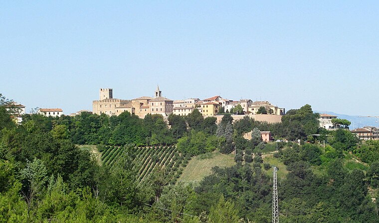
Photo: Toni Pecoraro, Public domain.
Sant'Angelo in Lizzola is a frazione of the comune of Vallefoglia in the province of Pesaro e Urbino in the Italian region Marche. It was a separate comune until 2013. The main parish church is the former collegiate church of San Michele Arcangelo.
Monte Albullo
- Type: Peak with an elevation of 505 metres
- Category: landform
- Location: Emilia-Romagna, Northeast Italy, Italy, Europe
- View on OpenStreetMap
Latitude
43.78° or 43° 46′ 48″ northLongitude
12.7957° or 12° 47′ 45″ eastElevation
505 metres (1,657 feet)Open location code
8FMJQQJW+27OpenStreetMap ID
node 12912976022OpenStreetMap feature
natural=peak
This page is based on OpenStreetMap, Wikidata, and Wikimedia Commons.
We’d love your help improving our open data sources. Thank you for contributing.
Satellite Map
Discover Monte Albullo from above in high-definition satellite imagery.
Localities in the Area
Explore places such as Capoville and Monte Santa Maria.
Notable Places Nearby
Highlights include Mombaroccio and Monte San Giovanni.
Emilia-Romagna: Must-Visit Destinations
Delve into Bologna, Ravenna, Parma, and Modena.
Curious Peaks to Discover
Uncover intriguing peaks from every corner of the globe.
About Mapcarta. Data © OpenStreetMap contributors and available under the Open Database License". Text is available under the CC BY-SA 4.0 license, except for photos, directions, and the map. Photo: Inkey, CC BY 3.0.