Isaac’s Market
Isaac’s Market is a convenience store in San Francisco, Bay Area, California. Isaac’s Market is situated nearby to the reservoir Cistern at Shotwell & 22nd, as well as near Treat Commons Community Garden.| Tap on a place to explore it |
Places of Interest Nearby
Highlights include New Mission Theater, San Francisco and San Francisco General Hospital.
New Mission Theater, San Francisco
Movie theater
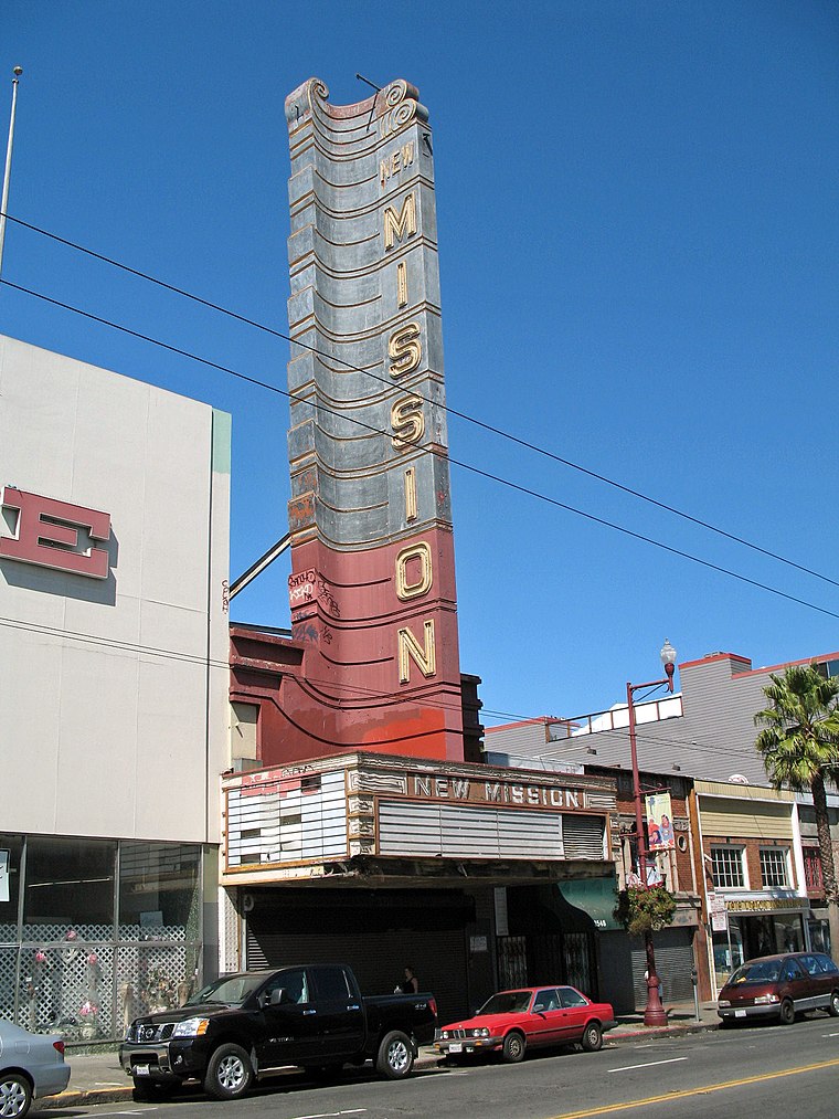
Photo: Sanfranman59, CC BY-SA 3.0.
The New Mission Theater is a historic building, built in 1916 and is located at 2550 Mission Street in San Francisco, California. The building is listed as a San Francisco Designated Landmark since May 27, 2004; and listed as one of the National Register of Historic Places since November 9, 2001. New Mission Theater, San Francisco is situated 1,500 feet west of Isaac’s Market.
San Francisco General Hospital
Hospital

Photo: LuisVilla, CC BY-SA 3.0.
The Priscilla Chan and Mark Zuckerberg San Francisco General Hospital and Trauma Center is a public hospital in San Francisco, California, under the purview of the city's Department of Public Health. San Francisco General Hospital is situated 2,600 feet east of Isaac’s Market.
Garfield Square
Park

Photo: LuisVilla, CC BY-SA 3.0.
Garfield Square, also known as Garfield Park, is a 3.46-acre city park located in the Mission District of San Francisco, California. It is bounded by 25th Street to the north, 26th Street to the south, Treat Avenue to the west, and Harrison Street to the east and was first opened in 1884.
Places in the Area
Nearby places include Mission and Potrero Hill.
Mission
Photo: Tim Bartel, CC BY-SA 2.0.
The Mission District is a district of San Francisco noted for its ethnic diversity, in particular the neighborhood's large Hispanic community. Though the district has gentrified and is among the more expensive areas for real estate in the city, many urban…
Potrero Hill
Quarter
 Potrero Hill is a residential neighborhood in San Francisco, California. It is known for being one of the sunniest neighborhoods in the city and having view of the skyline, Sutro Tower, Twin Peaks, and the bay.
Bernal Heights

Photo: Octoferret, CC BY-SA 2.5.
Bernal Heights, just south of the Mission District of San Francisco, is a cute, eclectic neighborhood that was once very working class, but is becoming quickly gentrified.
Isaac’s Market
- Type: Convenience store
- Categories: shop and food
- Location: San Francisco, Bay Area, California, United States, North America
- View on OpenStreetMap
Latitude
37.75561° or 37° 45′ 20″ northLongitude
-122.41424° or 122° 24′ 51″ westOpen location code
849VQH4P+68OpenStreetMap ID
node 12941401423OpenStreetMap feature
shop=convenience
This page is based on OpenStreetMap, Wikidata, and Wikimedia Commons.
We’d love your help improving our open data sources. Thank you for contributing.
Satellite Map
Discover Isaac’s Market from above in high-definition satellite imagery.
Notable Places Nearby
Highlights include Cistern at Shotwell & 22nd and Treat Commons Community Garden.
Nearby Places
Explore places such as Folsom Street & 22nd Street and Toss N Turn.
San Francisco: Must-Visit Destinations
Delve into Golden Gate, Chinatown-North Beach, Civic Center-Tenderloin, and Fisherman’s Wharf.
Curious Convenience Stores to Discover
Uncover intriguing convenience stores from every corner of the globe.
About Mapcarta. Data © OpenStreetMap contributors and available under the Open Database License". Text is available under the CC BY-SA 4.0 license, except for photos, directions, and the map. Photo: Wikimedia, CC BY-SA 3.0.