Black Ponds
Black Ponds is a neighborhood in Koekelberg, Arrondissement of Brussels-Capital. Black Ponds is situated nearby to the town Koekelberg, as well as near the neighborhood Rive Gauche - Linkeroever.| Tap on a place to explore it |
- Type: Neighborhood
- Description: neighbourhood in Molenbeek, Brussels
- Also known as: “Étangs Noirs”, “Étangs Noirs - Zwarte Vijvers”, “Zwarte Vijvers”, and “Zwët Vaaiver”
Places of Interest
Highlights include Place des Étangs Noirs - Zwarte Vijversplein and Étangs Noirs metro station.
Place des Étangs Noirs - Zwarte Vijversplein
Square

Photo: Wikimedia, CC BY-SA 4.0.
Place des Étangs Noirs - Zwarte Vijversplein is a square.
Étangs Noirs metro station
Metro station

Photo: Uppploader, CC BY-SA 3.0.
Étangs Noirs or Zwarte Vijvers is a Brussels Metro station on lines 1 and 5. It is located at the border between the municipalities of Koekelberg and Molenbeek-Saint-Jean, in the western part of Brussels, Belgium.
Grand Place
Square

Photo: Celuici, CC BY-SA 4.0.
The Grand-Place or Grote Markt is the central square of Brussels, Belgium. It is surrounded by opulent Baroque guildhalls of the former Guilds of Brussels and two larger edifices; the city's Flamboyant Town Hall, and the neo-Gothic King's House or Bread House building, containing the Brussels City Museum.
Places in the Area
Nearby places include Koekelberg and Molenbeek and surroundings.
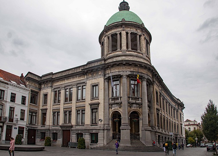
Koekelberg
Town

Photo: Dilaudid, CC BY-SA 3.0.
Koekelberg is one of the 19 municipalities of the Brussels-Capital Region, Belgium. Located in the north-western part of the region, it is bordered by Berchem-Sainte-Agathe, Ganshoren, Jette, and Molenbeek-Saint-Jean.
Molenbeek and surroundings
 Molenbeek and neighbouring quarters in Brussels have a bit of a shoddy reputation, in part due to overhyped media reports and in part due to genuine issues.
Rive Gauche - Linkeroever
Neighborhood

Photo: Mario Scolas, CC BY-SA 3.0.
Rive Gauche - Linkeroever is a neighborhood.
Black Ponds
- Categories: neighbourhood of Brussels and locality
- Location: Koekelberg, Arrondissement of Brussels-Capital, Brussels, Brussels Capital, Belgium, Benelux, Europe
- View on OpenStreetMap
Latitude
50.8571° or 50° 51′ 26″ northLongitude
4.33257° or 4° 19′ 57″ eastOpen location code
9F26V84M+R2OpenStreetMap ID
node 12944473009OpenStreetMap feature
place=neighbourhoodWikidata ID
Q135009056
This page is based on OpenStreetMap, Wikidata, and Wikimedia Commons.
We’d love your help improving our open data sources. Thank you for contributing.
Satellite Map
Discover Black Ponds from above in high-definition satellite imagery.
In Other Languages
From Dutch to German—“Black Ponds” goes by many names.
- Dutch: “Étangs Noirs”
- Dutch: “Zwarte Vijvers”
- Dutch: “Zwët Vaaiver”
- French: “Étangs Noirs”
- German: “Étangs Noirs”
- German: “Schwarze Teiche”
- German: “Zwarte Vijvers”
- German: “Zwët Vaaiver”
Localities in the Area
Explore places such as Gazomètre - Gasmeter and Maritime Quarter.
Notable Places Nearby
Highlights include Foyer koekelbergeois - Koekelbergse Haard and Masjid Attadamoun.
Belgium: Must-Visit Destinations
Delve into Brussels, Antwerp, Ghent, and Liège.
Curious Neighborhoods to Discover
Uncover intriguing neighborhoods from every corner of the globe.
About Mapcarta. Data © OpenStreetMap contributors and available under the Open Database License". Text is available under the CC BY-SA 4.0 license, except for photos, directions, and the map. Photo: Hullie, CC BY-SA 3.0.