74 Oaklands
74 Oaklands is a social service facility in Chippenham, Wiltshire, England which is located on Oaklands. 74 Oaklands is situated nearby to St Paul’s Primary School, as well as near St Nicholas School.| Tap on a place to explore it |
Places of Interest Nearby
Highlights include Chippenham railway station and Church of St Paul.
Chippenham railway station
Railway station
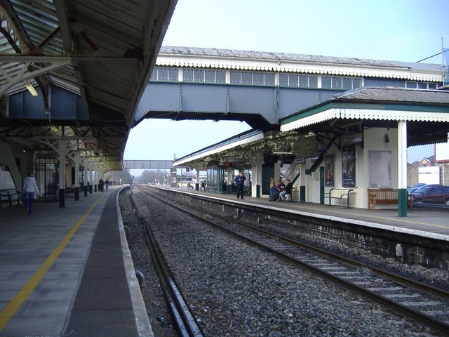
Photo: Roger Cornfoot, CC BY-SA 2.0.
Chippenham railway station is on the Great Western Main Line in South West England, serving the town of Chippenham, Wiltshire. It is 93 miles 76 chains down the line from the zero point at London Paddington and is situated between Swindon and Bath Spa on the GWML. Chippenham railway station is situated 3,400 feet south of 74 Oaklands.
Church of St Paul
Church

Photo: Betty Longbottom, CC BY-SA 2.0.
Church of St Paul is situated 2,400 feet south of 74 Oaklands.
Church of St Nicholas, Hardenhuish
Church

Photo: Tristan Forward, CC BY-SA 2.0.
Church of St Nicholas, Hardenhuish is situated 2,300 feet west of 74 Oaklands.
Places in the Area
Nearby places include Langley Burrell and Allington.
Langley Burrell
Village

Photo: ChurchCrawler, CC BY-SA 2.0.
Langley Burrell is a village in the civil parish of Langley Burrell Without, just north of Chippenham, Wiltshire, England. It is the largest settlement in the parish, which includes the hamlets of Peckingell and Kellaways.
Allington
Hamlet

Photo: Maurice Pullin, CC BY-SA 2.0.
Allington is a hamlet in north Wiltshire, England. It is on the edge of the market town of Chippenham, about 2 miles north-west of the town centre and about 0.3 miles north of the A420 road towards Bristol.
Tytherton Lucas
Hamlet

Photo: ChurchCrawler, CC BY-SA 2.0.
Tytherton Lucas is a hamlet in the civil parish of Bremhill in the ceremonial county of Wiltshire, England. Its nearest town is Chippenham, which lies approximately 2 miles south-west from the hamlet. Tytherton Lucas is situated 2 miles east of 74 Oaklands.
74 Oaklands
- Type: Social service facility
- Address: 74 Oaklands, SN15 1RQ
- Location: Chippenham, Wiltshire, West Country, England, United Kingdom, Britain and Ireland, Europe
- View on OpenStreetMap
Latitude
51.47092° or 51° 28′ 15″ northLongitude
-2.12121° or 2° 7′ 16″ westOpen location code
9C3VFVCH+9GOpenStreetMap ID
node 12960057872OpenStreetMap feature
amenity=social_facility
This page is based on OpenStreetMap, Wikidata, and Wikimedia Commons.
We’d love your help improving our open data sources. Thank you for contributing.
Satellite Map
Discover 74 Oaklands from above in high-definition satellite imagery.
Notable Places Nearby
Highlights include St Paul’s Primary School and St Nicholas School.
Nearby Places
Explore places such as Co-op Food and Long Ridings.
Wiltshire: Must-Visit Destinations
Delve into Stonehenge, Salisbury, Warminster, and Swindon.
Curious Social Service Facilities to Discover
Uncover intriguing social service facilities from every corner of the globe.
About Mapcarta. Data © OpenStreetMap contributors and available under the Open Database License". Text is available under the CC BY-SA 4.0 license, except for photos, directions, and the map. Photo: Rodhullandemu, CC BY-SA 3.0.