Pool Farm
Pool Farm is a farm in Hamfallow, Stroud District, England. Pool Farm is situated nearby to the village Breadstone, as well as near the forest Bushy Grove.| Tap on a place to explore it |
Places of Interest Nearby
Highlights include Dr. Jenner’s House and Berkeley Town Hall.
Dr. Jenner’s House
Museum
 Dr. Jenner's House, formerly known as the Edward Jenner Museum, in Berkeley, England, is housed in a grade II* listed early 18th century building called the Chantry, famous as the home of Edward Jenner FRS, physician, surgeon and pioneer of smallpox vaccination, and now used as a museum. Dr. Jenner’s House is situated 2 miles southwest of Pool Farm.
Berkeley Town Hall
Town hall
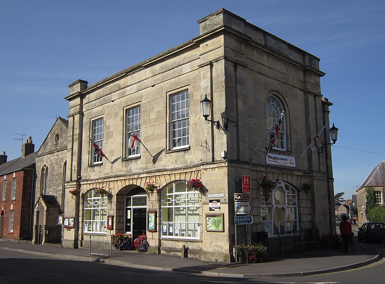
Photo: My another account, CC0.
Berkeley Town Hall is a municipal building in Salter Street, Berkeley, Gloucestershire, England. The structure, which is now used as a community events venue, is a Grade II listed building. Berkeley Town Hall is situated 2 miles west of Pool Farm.
St Mary’s Church, Berkeley
Church

Photo: David Stowell, CC BY-SA 2.0.
The Church of St Mary the Virgin is an Anglican church in Berkeley, Gloucestershire, England, and in the Diocese of Gloucester. The building is Grade I listed; it has a separate tower, also Grade I listed. St Mary’s Church, Berkeley is situated 2 miles southwest of Pool Farm.
Places in the Area
Nearby places include Breadstone and Stinchcombe.
Breadstone
Village

Photo: ChurchCrawler, CC BY-SA 2.0.
Breadstone is a village and former civil parish, now in the parish of Hamfallow, in the Stroud district, in the county of Gloucestershire, England. In 1931, the parish had a population of 95.
Stinchcombe
Village

Photo: Stuart Buchan, CC BY-SA 2.0.
Stinchcombe is a small village and civil parish in Gloucestershire, England on the B4060 road between Dursley and North Nibley. The church is called St Cyr's and its churchyard contains 40–60 gravestones.
Newport
Hamlet

Photo: Jonathan Billinger, CC BY-SA 2.0.
Newport is a village in Alkington parish, Gloucestershire, England. Located along the A38 road roughly halfway between Bristol and Gloucester. It is located about a mile south-east of Berkeley and just north of Woodford. Newport is situated 2 miles southwest of Pool Farm.
Pool Farm
- Type: Farm
- Category: agriculture
- Location: Hamfallow, Stroud District, Gloucestershire, West Country, England, United Kingdom, Britain and Ireland, Europe
- View on OpenStreetMap
Latitude
51.70223° or 51° 42′ 8″ northLongitude
-2.41607° or 2° 24′ 58″ westOpen location code
9C3VPH2M+VHOpenStreetMap ID
node 1296167937OpenStreetMap feature
landuse=farm
This page is based on OpenStreetMap, Wikidata, and Wikimedia Commons.
We’d love your help improving our open data sources. Thank you for contributing.
Satellite Map
Discover Pool Farm from above in high-definition satellite imagery.
Places with the Same Name
Discover other places named “Pool Farm”.
Notable Places Nearby
Highlights include Bushy Grove and The Sand Barn.
Nearby Places
Explore places such as Whitehall Farm and Ivy Farm.
Gloucestershire: Must-Visit Destinations
Delve into Gloucester, Cheltenham, Cirencester, and Yate.
Curious Farms to Discover
Uncover intriguing farms from every corner of the globe.
About Mapcarta. Data © OpenStreetMap contributors and available under the Open Database License". Text is available under the CC BY-SA 4.0 license, except for photos, directions, and the map. Photo: Matthew Hartley, CC BY-SA 2.0.