Bildstock Hahnkreuz
Bildstock Hahnkreuz is a wayside shrine in Altlichtenwarth, Mistelbach District, Lower Austria. Bildstock Hahnkreuz is situated nearby to the cemetery Gräberanlage, as well as near the peak Hutsaulberg.| Tap on a place to explore it |
Places of Interest Nearby
Highlights include Altlichtenwarth Kaiser Franz Joseph-Denkmal and Altlichtenwarth airfield.
Altlichtenwarth Kaiser Franz Joseph-Denkmal
Memorial

Photo: Priwo, Public domain.
Altlichtenwarth Kaiser Franz Joseph-Denkmal is a memorial, which is situated 440 metres southwest of Bildstock Hahnkreuz.
Altlichtenwarth airfield
Aerodrome

Photo: Carsten Steger, CC BY-SA 4.0.
Altlichtenwarth airfield is an aerodrome, which is situated 2½ km northeast of Bildstock Hahnkreuz.
Church of St. Vitus
Church

Photo: Doronenko, CC BY-SA 3.0 at.
Church of St. Vitus is situated 3 km southeast of Bildstock Hahnkreuz.
Places in the Area
Nearby places include Katzelsdorf and Hohenau an der March.
Katzelsdorf
Village

Photo: Wikimedia, CC BY-SA 3.0.
Katzelsdorf is a village, which is situated 6 km north of Bildstock Hahnkreuz.
Hohenau an der March
Village
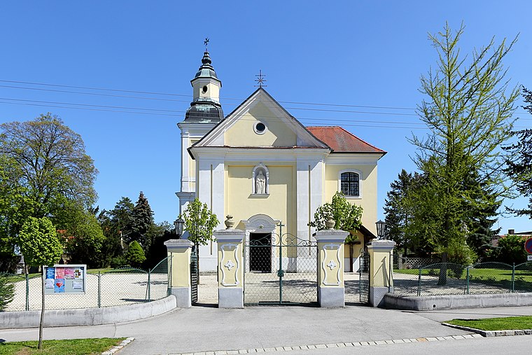
Photo: Bwag, CC BY-SA 4.0.
Hohenau an der March is a town in the district of Gänserndorf in the Austrian state of Lower Austria, close to Vienna and the borders with the Czech Republic and Slovakia. Hohenau an der March is situated 9 km southeast of Bildstock Hahnkreuz.
Bildstock Hahnkreuz
- Type: Wayside shrine
- Category: historic site
- Location: Altlichtenwarth, Mistelbach District, Lower Austria, Austria, Central Europe, Europe
- View on OpenStreetMap
Latitude
48.64992° or 48° 38′ 60″ northLongitude
16.80038° or 16° 48′ 1″ eastOpen location code
8FWRJRX2+X5OpenStreetMap ID
node 1297035852OpenStreetMap feature
historic=wayside_shrine
This page is based on OpenStreetMap, Wikidata, and Wikimedia Commons.
We’d love your help improving our open data sources. Thank you for contributing.
Satellite Map
Discover Bildstock Hahnkreuz from above in high-definition satellite imagery.
Notable Places Nearby
Highlights include Gräberanlage and Hutsaulberg.
Nearby Places
Explore places such as Pforakeller and 777 Jahre Altlichtenwarth.
Lower Austria: Must-Visit Destinations
Delve into St. Pölten, Wiener Neustadt, Amstetten, and Klosterneuburg.
Curious Wayside Shrines to Discover
Uncover intriguing wayside shrines from every corner of the globe.
About Mapcarta. Data © OpenStreetMap contributors and available under the Open Database License". Text is available under the CC BY-SA 4.0 license, except for photos, directions, and the map. Photo: Lonezor, CC BY-SA 3.0.