Čuden Ranč
Čuden Ranč is a picnic site in Ljubljana, Slovenia which is located on Gabrje. Čuden Ranč is situated nearby to Gabrje Pond, as well as near the hamlet Toško Čelo.| Tap on a place to explore it |
Places of Interest Nearby
Highlights include St. Anthony the Great Church and Church of the Assumption of Mary.
St. Anthony the Great Church
Church

Photo: Doremo, CC BY-SA 4.0.
St. Anthony the Great Church is situated 2½ km east of Čuden Ranč.
Church of the Assumption of Mary
Church

Photo: Doremo, CC BY-SA 3.0.
Church of the Assumption of Mary is situated 3 km south of Čuden Ranč.
Slavkov dom na Golem brdu
Restaurant
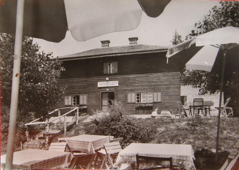
Photo: Wikimedia, Public domain.
Slavkov dom na Golem brdu is a restaurant, which is situated 3 km north of Čuden Ranč.
Places in the Area
Nearby places include Toško Čelo and Gabrje.
Toško Čelo
Hamlet

Photo: Sl-Ziga, CC BY-SA 3.0.
Toško Čelo is a dispersed settlement on the slope of the hill known as Tošč Face, part of the Polhov Gradec Hills, west of the capital Ljubljana in central Slovenia.
Gabrje
Village

Photo: Doremo, CC BY-SA 3.0.
Gabrje is a settlement north of Dobrova in the Municipality of Dobrova–Polhov Gradec in the Upper Carniola region of Slovenia. It also comprises the hamlets of Jarčji Potok, Knapovec, Pod Kotom, Ravnik, and Žerovnik.
Stranska vas
Village

Photo: Doremo, Public domain.
Stranska Vas is a clustered village northeast of Dobrova in the Municipality of Dobrova–Polhov Gradec in the Upper Carniola region of Slovenia.
Čuden Ranč
- Type: Picnic site
- Address: Gabrje 96a
- Category: tourism
- Location: Ljubljana, Slovenia, Central Europe, Europe
- View on OpenStreetMap
Latitude
46.07833° or 46° 4′ 42″ northLongitude
14.41345° or 14° 24′ 48″ eastOpen location code
8FRP3CH7+89OpenStreetMap ID
node 13011829909OpenStreetMap feature
tourism=picnic_site
This page is based on OpenStreetMap, Wikidata, and Wikimedia Commons.
We’d love your help improving our open data sources. Thank you for contributing.
Satellite Map
Discover Čuden Ranč from above in high-definition satellite imagery.
Notable Places Nearby
Highlights include Gabrje Pond and Lokostrelsko društvo Ishi Vodice.
Nearby Places
Explore places such as Gabrje pri Dobrovi, Pod Kotom and Ekološka kmetija Levičnik.
Slovenia: Must-Visit Destinations
Delve into Ljubljana, Maribor, Koper, and Celje.
Curious Picnic Sites to Discover
Uncover intriguing picnic sites from every corner of the globe.
About Mapcarta. Data © OpenStreetMap contributors and available under the Open Database License". Text is available under the CC BY-SA 4.0 license, except for photos, directions, and the map. Photo: Jjtkk, CC BY 3.0.