Park End Close
Park End Close is a bus stop in Bodicote, Cherwell, England. Park End Close is situated nearby to Bishop Loveday Church of England Primary School, as well as near the building Bodicote House.| Tap on a place to explore it |
Places of Interest Nearby
Highlights include Church of St John the Baptist, Bodicote and Horton General Hospital.
Church of St John the Baptist, Bodicote
Church
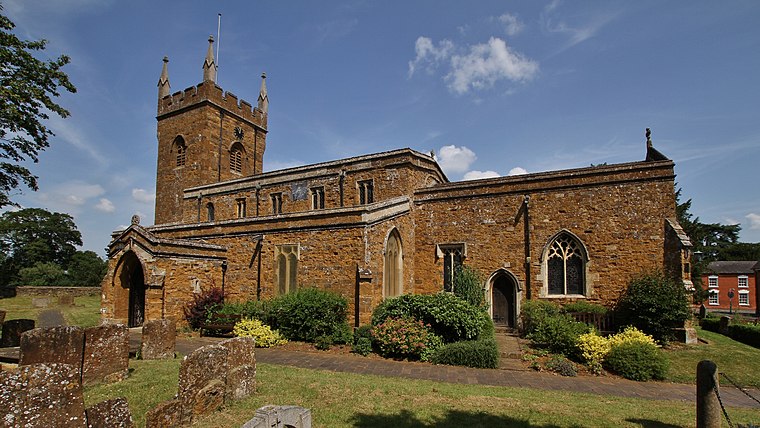
Photo: Motacilla, CC BY-SA 4.0.
Church of St John the Baptist, Bodicote is situated 2,300 feet southwest of Park End Close.
Horton General Hospital
Hospital
 The Horton General Hospital is a National Health Service hospital located on the Oxford Road, in the Calthorpe ward of Banbury. It is managed by Oxford University Hospitals NHS Foundation Trust. Horton General Hospital is situated 1 mile northwest of Park End Close.
Blessed George Napier Catholic School
School
Blessed George Napier Catholic School, known locally as BGN, is a Catholic secondary school and sixth form with academy status. It is located on Addison Road in the Easington ward of Banbury, Oxfordshire, England. Blessed George Napier Catholic School is situated 4,200 feet northwest of Park End Close.
Places in the Area
Nearby places include Twyford and Banbury.
Twyford
Quarter

Photo: Mat Fascione, CC BY-SA 2.0.
Adderbury is a winding linear village and rural civil parish about 3 miles south of Banbury in northern Oxfordshire, England. The settlement has five sections: the new Milton Road housing Development and West Adderbury, towards the southwest; East Adderbury…
Banbury

Photo: Johnfield1, CC BY-SA 3.0.
Banbury is a market town in the Cherwell district of Oxfordshire. It is known for the nursery rhyme "Ride-a-cock-horse" and Banbury cakes. The local football team is Banbury United and they play at the Spencer stadium.
Grimsbury
Suburb
Grimsbury is a largely residential area which forms the eastern part of Banbury, in the Cherwell district, in the county of, Oxfordshire, England. It is situated east of the River Cherwell, the Oxford Canal and the Cherwell Valley Line railway. Grimsbury is situated 2 miles north of Park End Close.
Park End Close
- Type: Bus stop
- Category: transportation
- Location: Bodicote, Cherwell, Oxfordshire, South East England, England, United Kingdom, Britain and Ireland, Europe
- View on OpenStreetMap
Latitude
52.04123° or 52° 2′ 28″ northLongitude
-1.32628° or 1° 19′ 35″ westOpen location code
9C4W2MRF+FFOpenStreetMap ID
node 13012328344OpenStreetMap feature
highway=bus_stopOpenStreetMap feature
public_transport=platform
This page is based on OpenStreetMap, Wikidata, and Wikimedia Commons.
We’d love your help improving our open data sources. Thank you for contributing.
Satellite Map
Discover Park End Close from above in high-definition satellite imagery.
Notable Places Nearby
Highlights include Bishop Loveday Church of England Primary School and Bodicote House.
Nearby Places
Explore places such as Broad Gap and Asda Express.
Oxfordshire: Must-Visit Destinations
Delve into Oxford, Abingdon-on-Thames, Banbury, and Woodstock.
Curious Bus Stops to Discover
Uncover intriguing bus stops from every corner of the globe.
About Mapcarta. Data © OpenStreetMap contributors and available under the Open Database License". Text is available under the CC BY-SA 4.0 license, except for photos, directions, and the map. Photo: Wikimedia, CC0.