Fafrees
Fafrees is a bike shop in Hounslow, Greater London, England. Fafrees is situated nearby to Hounslow Bus Station, as well as near the mosque Hounslow Muslim Centre.| Tap on a place to explore it |
Places of Interest Nearby
Highlights include Hounslow Town Primary School and Twickenham Stadium.
Hounslow Town Primary School
School
Hounslow is a large town in West London, England, 10+3⁄4 miles west-southwest of Charing Cross. It is the administrative centre of the London Borough of Hounslow, and is identified in the London Plan as one of the 14 metropolitan centres in Greater London. Hounslow Town Primary School is situated 560 feet east of Fafrees.
Twickenham Stadium
Stadium
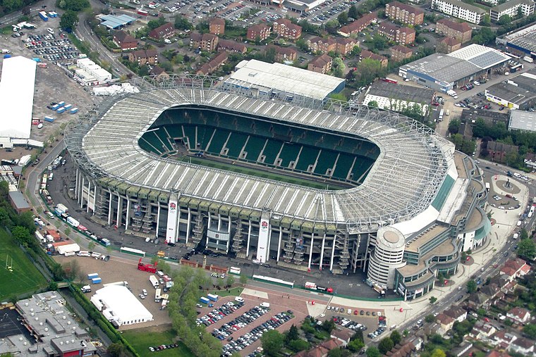
Photo: brewbooks, CC BY-SA 2.0.
Twickenham Stadium is a rugby union stadium in Twickenham, London, England. It is owned by the Rugby Football Union, the English rugby union governing body, which has its headquarters there. Twickenham Stadium is situated 1¼ miles southeast of Fafrees.
Places in the Area
Nearby places include Hounslow and Lampton.
Hounslow
Town

Photo: KTo288, CC BY-SA 3.0.
Hounslow is a large town in West London, England, 10+3⁄4 miles west-southwest of Charing Cross. It is the administrative centre of the London Borough of Hounslow, and is identified in the London Plan as one of the 14 metropolitan centres in Greater London.
Lampton
Neighborhood
Lampton is a small area of Hounslow located on the Great West Road in the London Borough of Hounslow, between Hounslow town centre and Heston. Its name derives from the Old English for 'lamb farm.' Lampton was traditionally the property of the Bulstrodes from…
Spring Grove
Suburb
Spring Grove is the north-western district of the town of Isleworth within the Borough of Hounslow in London, England. In general terms it lies east of the district of Lampton; north of the district of Woodlands; west of the Barnes-to-Feltham railway loop line; and south of the district of Osterley.
Fafrees
- Type: Bike shop
- Category: shop
- Location: Hounslow, Greater London, England, United Kingdom, Britain and Ireland, Europe
- View on OpenStreetMap
Latitude
51.47038° or 51° 28′ 13″ northLongitude
-0.35597° or 0° 21′ 22″ westOpen location code
9C3XFJCV+5JOpenStreetMap ID
node 13026845742OpenStreetMap feature
shop=bicycle
This page is based on OpenStreetMap, Wikidata, and Wikimedia Commons.
We’d love your help improving our open data sources. Thank you for contributing.
Satellite Map
Discover Fafrees from above in high-definition satellite imagery.
Notable Places Nearby
Highlights include Hounslow Bus Station and Hounslow Muslim Centre.
Nearby Places
Explore places such as Sanna Travel and The Kanteen.
England: Must-Visit Destinations
Delve into London, Manchester, Sheffield, and Leeds.
Curious Bike Shops to Discover
Uncover intriguing bike shops from every corner of the globe.
About Mapcarta. Data © OpenStreetMap contributors and available under the Open Database License". Text is available under the CC BY-SA 4.0 license, except for photos, directions, and the map. Photo: sidibousaid, CC BY 2.0.