Capital City Sweets
Capital City Sweets is a fast food restaurant in Lansing, Ingham, Michigan which is located on East Michigan Avenue. Capital City Sweets is situated nearby to the pitch Kircher Municipal Field, as well as near the theater building Jack C. & Susan Davis Amphitheater.| Tap on a place to explore it |
- Opening hours: noon—10:00 PM
- Type: Fast food restaurant
- Cuisine: ice cream
- Address: 3112 East Michigan Avenue, Lansing, MI 48912
Places of Interest Nearby
Highlights include Frandor Shopping Center and Breslin Student Events Center.
Frandor Shopping Center
Commercial area

Photo: Dj1997, CC BY-SA 3.0.
Frandor Shopping Center, in Lansing, Michigan, is located at the very eastern edge of the city bordering the neighboring city of East Lansing and freeway US Highway 127. Frandor Shopping Center is situated 1,500 feet north of Capital City Sweets.
Breslin Student Events Center
Stadium
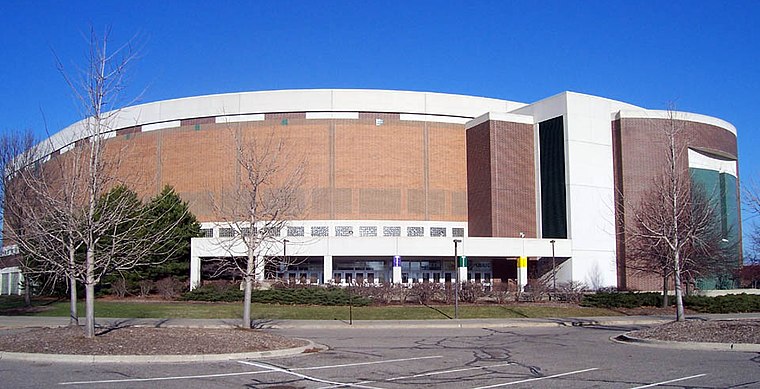
Photo: Lovelac7, CC BY-SA 3.0.
The Jack Breslin Student Events Center is a multi-purpose arena at Michigan State University in East Lansing, Michigan. The arena opened in 1989, and is named for Jack Breslin, MSU alumnus, former athlete and administrator, who first began pushing for the arena in 1969. Breslin Student Events Center is situated 1 mile southeast of Capital City Sweets.
Jenison Fieldhouse
Stadium

Photo: Ptpower, CC BY-SA 2.5.
Jenison Fieldhouse is a 10,004-seat, later reduced to 6,000-seat, multi-purpose arena in East Lansing, Michigan. The arena opened in 1940 and was named for alumnus Frederick Cowles Jenison, whose estate, along with PWAP funds, funded the building. Jenison Fieldhouse is situated 1 mile east of Capital City Sweets.
Places in the Area
Nearby places include East Lansing and REO Town.
East Lansing
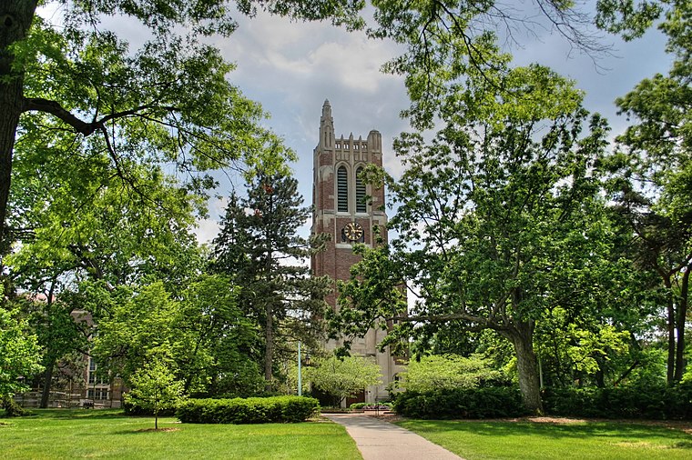
Photo: Jeffness, CC BY-SA 2.5.
East Lansing is a city in the U.S. state of Michigan. Most of the city lies within Ingham County, although a small portion extends north into Clinton County.
REO Town
Neighborhood

Photo: Dj1997, CC BY-SA 3.0.
REO Town is a district in Lansing, Michigan, United States, located south of downtown. The neighborhood is bordered by West Malcolm X Street to the north; South Cedar Street BL I-96 to the east; West Mount Hope Avenue to the south; and Townsend Street, the Grand River, and South Martin Luther King Jr. REO Town is situated 2½ miles west of Capital City Sweets.
Okemos
Town

Photo: Dj1997, CC BY-SA 3.0.
Okemos is a census-designated place in Ingham County in the U.S. state of Michigan. The population of the CDP was 25,121 at the 2020 census. Okemos is part of the urban area of Lansing–East Lansing, and is located near the campus of Michigan State University. Okemos is situated 4 miles east of Capital City Sweets.
Capital City Sweets
- Categories: food and restaurant
- Location: Lansing, Ingham, Central Michigan, Michigan, Midwest, United States, North America
- View on OpenStreetMap
Latitude
42.73312° or 42° 43′ 59″ northLongitude
-84.50767° or 84° 30′ 28″ westOpen location code
86JQPFMR+6WOpenStreetMap ID
node 13042270880OpenStreetMap feature
amenity=fast_foodOpenStreetMap attribute
cuisine=ice_cream
This page is based on OpenStreetMap, Wikidata, and Wikimedia Commons.
We’d love your help improving our open data sources. Thank you for contributing.
Satellite Map
Discover Capital City Sweets from above in high-definition satellite imagery.
Notable Places Nearby
Highlights include Kircher Municipal Field and Jack C. & Susan Davis Amphitheater.
Nearby Places
Explore places such as Orthopaedic Rehabilitation Specialists and Hooked.
Central Michigan: Must-Visit Destinations
Delve into Flint, Bay City, Saginaw, and East Lansing.
Curious Fast Food Restaurants to Discover
Uncover intriguing fast food restaurants from every corner of the globe.
About Mapcarta. Data © OpenStreetMap contributors and available under the Open Database License". Text is available under the CC BY-SA 4.0 license, except for photos, directions, and the map. Photo: Brett Marr, CC BY-SA 3.0.