Obstbaumpfad Staufen 4
Obstbaumpfad Staufen 4 is in Staufen im Breisgau, Breisgau-Hochschwarzwald, Baden-Württemberg. Obstbaumpfad Staufen 4 is situated nearby to the church Magdalenenkapelle, as well as near the scenic viewpoint Burg Staufen.| Tap on a place to explore it |
Places of Interest Nearby
Highlights include Magdalenenkapelle and Staufen railway station.
Magdalenenkapelle
Church

Photo: Joergens.mi, CC BY-SA 3.0.
Magdalenenkapelle is a church, which is situated 310 metres southwest of Obstbaumpfad Staufen 4.
Staufen railway station
Railway station

Photo: Smiley.toerist, CC BY-SA 4.0.
Staufen railway station is situated 670 metres south of Obstbaumpfad Staufen 4.
Rathaus
Town hall

Photo: Andreas Schwarzkopf, CC BY-SA 3.0.
Rathaus is a town hall, which is situated 1 km south of Obstbaumpfad Staufen 4.
Places in the Area
Nearby places include Bad Krozingen and Tunsel.
Bad Krozingen
Town
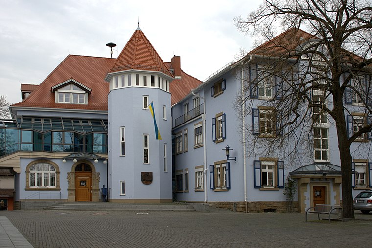
Photo: Ireas, CC BY-SA 4.0.
Bad Krozingen is a spa town in the district Breisgau-Hochschwarzwald, in Baden-Württemberg, Germany. It is situated 15 km southwest of Freiburg. In the 1970s, the previously independent villages Biengen, Hausen an der Möhlin, Schlatt and Tunsel, including Schmidhofen, became part of Bad Krozingen. Bad Krozingen is situated 3 km northwest of Obstbaumpfad Staufen 4.
Tunsel
Village
Tunsel is a village in the district of Breisgau-Hochschwarzwald in Baden-Württemberg. Since January 1974, it is an Ortsteil of Bad Krozingen. Tunsel is situated 5 km west of Obstbaumpfad Staufen 4.
Pfaffenweiler
Village
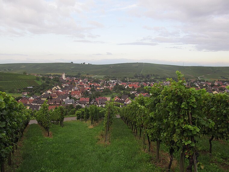
Photo: Gortyna, CC BY-SA 3.0.
Pfaffenweiler is a municipality in the district of Breisgau-Hochschwarzwald in Baden-Württemberg in southern Germany. The landscape here is shaped as much by vineyards as by history. Pfaffenweiler is situated 5 km north of Obstbaumpfad Staufen 4.
Obstbaumpfad Staufen 4
- Type: Sign
- Categories: information and tourism
- Location: Staufen im Breisgau, Breisgau-Hochschwarzwald, Freiburg Region, Baden-Württemberg, Germany, Central Europe, Europe
- View on OpenStreetMap
Latitude
47.89123° or 47° 53′ 28″ northLongitude
7.73076° or 7° 43′ 51″ eastOpen location code
8FV9VPRJ+F8OpenStreetMap ID
node 13073674209OpenStreetMap feature
tourism=information
This page is based on OpenStreetMap, Wikidata, and Wikimedia Commons.
We’d love your help improving our open data sources. Thank you for contributing.
Satellite Map
Discover Obstbaumpfad Staufen 4 from above in high-definition satellite imagery.
Notable Places Nearby
Highlights include Burg Staufen and Sonnenhof.
Nearby Places
Explore places such as Wertstoffhof und Grünschnittsammelstelle and Bauhof.
Baden-Württemberg: Must-Visit Destinations
Delve into Stuttgart, Heidelberg, Karlsruhe, and Mannheim.
Curious Places to Discover
Uncover intriguing places from every corner of the globe.
About Mapcarta. Data © OpenStreetMap contributors and available under the Open Database License". Text is available under the CC BY-SA 4.0 license, except for photos, directions, and the map. Photo: Traveler100, CC BY-SA 3.0.