National Memorial Amphitheater
National Memorial Amphitheater is in Unorganized Territory of Mount Rushmore, Pennington, South Dakota. National Memorial Amphitheater is situated nearby to Hall of Records, as well as near the peak Mount Rushmore.| Tap on a place to explore it |
Places of Interest Nearby
Highlights include Mount Rushmore.
Mount Rushmore

Photo: ArthurTilton, CC BY-SA 3.0.
The Mount Rushmore National Memorial is a national memorial centered on a colossal sculpture carved into the granite face of Mount Rushmore in the Black Hills near Keystone, South Dakota, United States.
Places in the Area
Nearby places include Mount Rushmore National Memorial and Keystone.
Mount Rushmore National Memorial
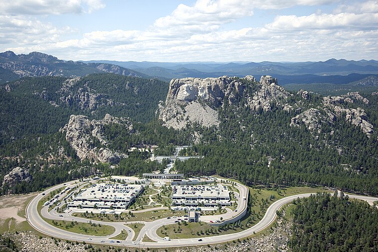
Photo: Carol M. Highsmith, Public domain.
Mount Rushmore National Memorial is a United States national memorial in the Black Hills of west South Dakota. This national icon features the monumental faces of four former Presidents – George Washington, Thomas Jefferson, Teddy Roosevelt, and Abraham Lincoln – blasted and carved from the white rock of a mountain.
Keystone
 Keystone is a tiny town in the Black Hills of South Dakota, at the entrance to the popular Mount Rushmore National Memorial. It offers a full range of accommodations, but at the price of a "tourist trap" veneer.
Etta
Locality
Etta, also known as Etta Camp and Etta Mine, is a ghost town in Pennington County, South Dakota, United States. It was a successful mining town, known for its discovery of the largest spodumene crystal ever found. Etta is situated 2 miles east of National Memorial Amphitheater.
National Memorial Amphitheater
- Type: Tourist attraction
- Category: tourism
- Location: Unorganized Territory of Mount Rushmore, Pennington, South Dakota, Great Plains, United States, North America
- View on OpenStreetMap
Latitude
43.8789° or 43° 52′ 44″ northLongitude
-103.4598° or 103° 27′ 35″ westOpen location code
85MRVGHR+H3OpenStreetMap ID
node 13109373514OpenStreetMap feature
tourism=attraction
This page is based on OpenStreetMap, Wikidata, and Wikimedia Commons.
We’d love your help improving our open data sources. Thank you for contributing.
Satellite Map
Discover National Memorial Amphitheater from above in high-definition satellite imagery.
Notable Places Nearby
Highlights include Hall of Records and Mount Rushmore.
Nearby Places
Explore places such as Thomas Jefferson and Theodore Roosevelt.
South Dakota: Must-Visit Destinations
Delve into Pierre, Sioux Falls, Rapid City, and Aberdeen.
Curious Places to Discover
Uncover intriguing places from every corner of the globe.
About Mapcarta. Data © OpenStreetMap contributors and available under the Open Database License". Text is available under the CC BY-SA 4.0 license, except for photos, directions, and the map. Photo: Wikimedia, CC0.