Loma La Olomina
Loma La Olomina is a locality in Morazán, Eastern El Salvador. Loma La Olomina is situated nearby to the village Talchiga, as well as near the locality El Carrizal.| Tap on a place to explore it |
Places in the Area
Nearby places include Arambala and Perquín.
Arambala
Town
Arambala is a district in the Morazán Department of El Salvador. As of 2003, it had a population of 2116. Arambala is situated 6 km southwest of Loma La Olomina.
Perquín
Town

Photo: Othlo, CC BY-SA 4.0.
Perquín is a municipality in the Morazán department of El Salvador. It is home to the Museum of the Revolution, which contains artifacts and exhibits related to the Salvadoran Civil War. Perquín is situated 6 km west of Loma La Olomina.
El Mozote
Village
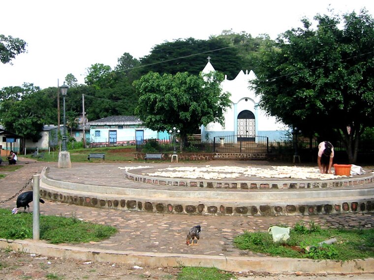
Photo: Efrojas, Public domain.
El Mozote is a village in the Morazán Department in El Salvador. It was the site of the El Mozote massacre during the civil war in December 1981 when nearly 1,000 civilians were killed by a Salvadoran Army unit known as the Atlácatl Battalion. El Mozote is situated 7 km south of Loma La Olomina.
Loma La Olomina
- Type: Locality
- Location: Morazán, Eastern El Salvador, El Salvador, Central America, North America
- View on OpenStreetMap
Latitude
13.96005° or 13° 57′ 36″ northLongitude
-88.10188° or 88° 6′ 7″ westOpen location code
765HXV6X+26OpenStreetMap ID
node 13122754105OpenStreetMap feature
place=locality
This page is based on OpenStreetMap, Wikidata, and Wikimedia Commons.
We’d love your help improving our open data sources. Thank you for contributing.
Satellite Map
Discover Loma La Olomina from above in high-definition satellite imagery.
Localities in the Area
Explore places such as Talchiga and El Carrizal.
Notable Places Nearby
Highlights include Loma de San Marcos and Loma Rincón Seco.
Eastern El Salvador: Must-Visit Destinations
Delve into San Miguel, La Unión, San Francisco Gotera, and Santa Rosa de Lima.
Curious Localities to Discover
Uncover intriguing localities from every corner of the globe.
About Mapcarta. Data © OpenStreetMap contributors and available under the Open Database License". Text is available under the CC BY-SA 4.0 license, except for photos, directions, and the map. Photo: Othlo, CC BY-SA 4.0.