Rise Park Infant School
Rise Park Infant School is a school in Havering, Greater London, England. Rise Park Infant School is situated nearby to KingsHeart Church, as well as near Havering Road Methodist Church.| Tap on a place to explore it |
Places of Interest Nearby
Highlights include Bedfords Park and Bower Park Academy.
Bedfords Park
Park

Photo: Ian Dalgliesh, CC BY-SA 2.0.
Bedfords Park is public open space of 215 acres or approximately 87½ hectares near Havering-atte-Bower in the London Borough of Havering in England. It is one of three large parklands around Havering-atte-Bower; the others are Havering Country Park and Pyrgo Park. Bedfords Park is situated 1 mile northeast of Rise Park Infant School.
Bower Park Academy
School
Bower Park Academy is a secondary school with academy status, located in the Romford area of the London Borough of Havering, London, England. Bower Park Academy is situated 3,200 feet north of Rise Park Infant School.
Romford Market
Marketplace
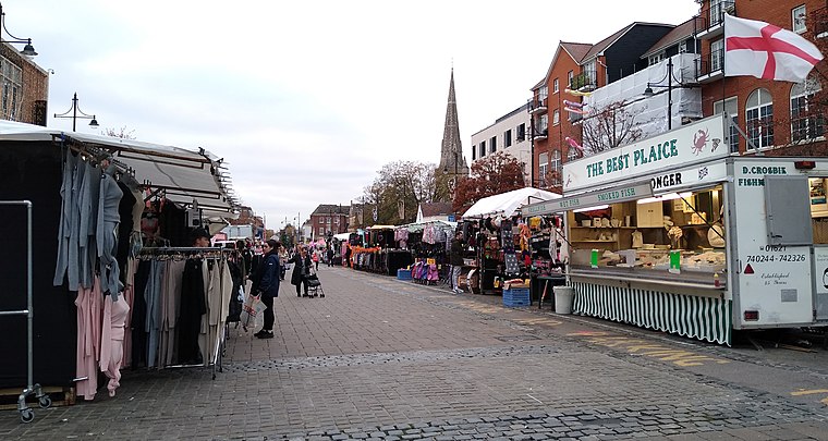
Photo: Mx. Granger, CC0.
Romford Market is a large outdoor retail market located in Romford in the London Borough of Havering, England. The market right was established by royal order in 1247. Romford Market is situated 1¼ miles south of Rise Park Infant School.
Places in the Area
Nearby places include Chase Cross and Collier Row.
Chase Cross
Village
Chase Cross is a district of the London Borough of Havering in London, England. Chase Cross lies 0.8 miles east of Collier Row, 15 miles northeast of Charing Cross and just under 2 miles north of Romford.
Collier Row
Suburb

Photo: John Winfield, CC BY-SA 2.0.
Collier Row is a neighbourhood to the north of Romford in Greater London, England, within the London Borough of Havering. It is a suburban development located 14 miles northeast of Charing Cross.
Romford
Town
Photo: MRSC, Public domain.
Romford is a large town in east London, England, located 14 mi northeast of Charing Cross. Part of the London Borough of Havering, the town is one of the major metropolitan centres of Greater London identified in the London Plan.
Rise Park Infant School
- Type: School
- Postal code: RM1 4UD
- Category: education
- Location: Havering, Greater London, England, United Kingdom, Britain and Ireland, Europe
- View on OpenStreetMap
Latitude
51.59668° or 51° 35′ 48″ northLongitude
0.17839° or 0° 10′ 42″ eastOperator
SFAET LtdOpen location code
9F32H5WH+M9OpenStreetMap ID
node 13142317619OpenStreetMap feature
amenity=school
This page is based on OpenStreetMap, Wikidata, and Wikimedia Commons.
We’d love your help improving our open data sources. Thank you for contributing.
Satellite Map
Discover Rise Park Infant School from above in high-definition satellite imagery.
Notable Places Nearby
Highlights include KingsHeart Church and Havering Road Methodist Church.
Nearby Places
Explore places such as Rise Park Junior School and Rise Park Infant and Junior Schools.
England: Must-Visit Destinations
Delve into London, Manchester, Sheffield, and Leeds.
Curious Schools to Discover
Uncover intriguing schools from every corner of the globe.
About Mapcarta. Data © OpenStreetMap contributors and available under the Open Database License". Text is available under the CC BY-SA 4.0 license, except for photos, directions, and the map. Photo: sidibousaid, CC BY 2.0.