Harani Hair
Harani Hair is a hairdresser in Cheltenham, Gloucestershire, England. Harani Hair is situated nearby to the pub The Bell Inn, as well as near the theater building The Playhouse.| Tap on a place to explore it |
Places of Interest Nearby
Highlights include The Playhouse and Cheltenham Town Hall.
The Playhouse
Theater building
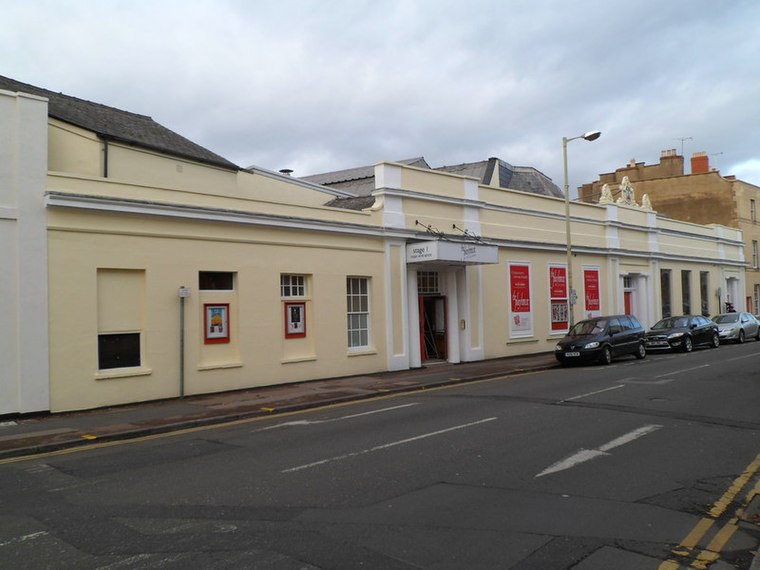
Photo: Jaggery, CC BY-SA 2.0.
Cheltenham Playhouse is a community theatre in Cheltenham, England, UK. It opened in 1945 as the Civic Playhouse and was run by the Corporation of Cheltenham; it was taken over by volunteers in 1958 who continue to run the operation as a registered charity.
Cheltenham Town Hall
Town hall

Photo: David Stowell, CC BY-SA 2.0.
Cheltenham Town Hall is an early-20th century assembly room in Cheltenham, England. Unlike most town halls, it is a public venue and not the seat of the borough council, which is housed in the nearby Municipal Offices. It is a Grade II listed building. Cheltenham Town Hall is situated 850 feet west of Harani Hair.

Places in the Area
Nearby places include Montpellier and Fairview.
Montpellier
Suburb

Photo: Edward, CC BY-SA 4.0.
Montpellier is a district of the Regency town Cheltenham Spa in Gloucestershire, England. Montpellier is one of the most historic areas of the Cheltenham, based at the end of the Promenade and south of the town centre.
Fairview
Suburb
Fairview is an area of Cheltenham, Gloucestershire, England. Situated between the town centre and Pittville, it is largely residential. There are a couple of businesses, including a local builders merchant and Cheltenham builder's merchant, George Bence, and a branch of Machinemart.
St. Pauls, Cheltenham
Suburb
St. Pauls is one of a number of areas of the Cotswold town of Cheltenham, Gloucestershire, England. St. Pauls is home to the Francis Close Hall, a campus of the University of Gloucestershire, St.
Harani Hair
- Type: Hairdresser
- Category: shop
- Location: Cheltenham, Gloucestershire, West Country, England, United Kingdom, Britain and Ireland, Europe
- View on OpenStreetMap
Latitude
51.89633° or 51° 53′ 47″ northLongitude
-2.07422° or 2° 4′ 27″ westOpen location code
9C3VVWWG+G8OpenStreetMap ID
node 13145934858OpenStreetMap feature
shop=hairdresser
This page is based on OpenStreetMap, Wikidata, and Wikimedia Commons.
We’d love your help improving our open data sources. Thank you for contributing.
Satellite Map
Discover Harani Hair from above in high-definition satellite imagery.
Notable Places Nearby
Highlights include ReSET Gym & Fitness and Number 6.
Nearby Places
Explore places such as The Bath Tavern and Arlington House.
Gloucestershire: Must-Visit Destinations
Delve into Gloucester, Cirencester, Yate, and Stroud.
Curious Hairdressers to Discover
Uncover intriguing hairdressers from every corner of the globe.
About Mapcarta. Data © OpenStreetMap contributors and available under the Open Database License". Text is available under the CC BY-SA 4.0 license, except for photos, directions, and the map. Photo: AlasdairW, CC BY-SA 3.0.