South Tacoma Way & 92nd Street South
South Tacoma Way & 92nd Street South is a shelter in Pierce, Washington. South Tacoma Way & 92nd Street South is situated nearby to the government office Pierce Transit Administration, as well as near the church Holiness Chapel.| Tap on a place to explore it |
Places of Interest Nearby
Highlights include Lakewood station and St. Clare Hospital.
Lakewood station
Railway station

Photo: Kgrr, CC BY-SA 3.0.
Lakewood station is a commuter rail station in Lakewood, Washington, United States. It is the terminus of the S Line of the Sounder commuter rail network, operated by Sound Transit in the Seattle metropolitan area. Lakewood station is situated 1½ miles southwest of South Tacoma Way & 92nd Street South.
St. Clare Hospital
Hospital
Lakewood is a city in Pierce County, Washington, United States. The population was 63,612 at the 2020 census. It is the second-largest city in the county, behind Tacoma, and is a suburban bedroom community. St. Clare Hospital is situated 1½ miles southwest of South Tacoma Way & 92nd Street South.
South Tacoma station
Railway station
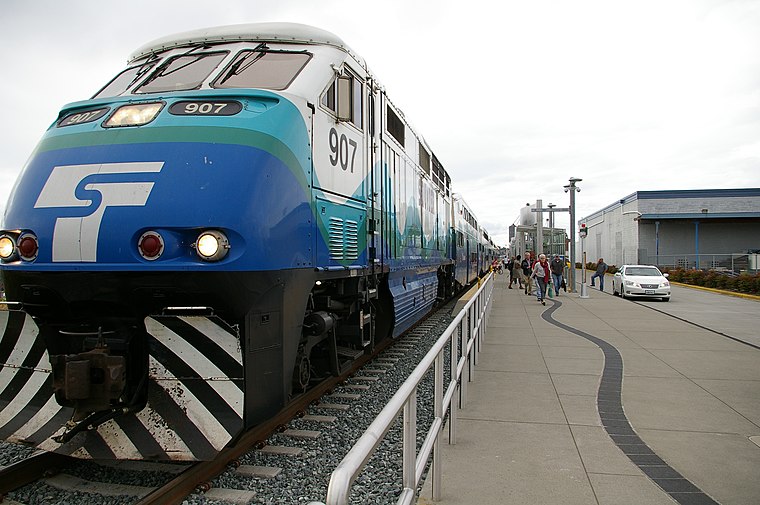
Photo: Kgrr, CC BY-SA 3.0.
South Tacoma station is a commuter rail station in Tacoma, Washington, United States, served by the S Line of the Sounder commuter rail network. It is located near the Tacoma Mall along South Tacoma Way at South 56th Street and consists of a single platform and a 220-stall park-and-ride lot. South Tacoma station is situated 2 miles north of South Tacoma Way & 92nd Street South.
Places in the Area
Nearby places include Lakewood and Fern Hill.
Lakewood
Town

Photo: Veterans Health, Public domain.
Lakewood is a city in Pierce County, Washington, United States. The population was 63,612 at the 2020 census. It is the second-largest city in the county, behind Tacoma, and is a suburban bedroom community. Lakewood is situated 1½ miles west of South Tacoma Way & 92nd Street South.
Fern Hill
Quarter

Photo: Visitor7, CC BY-SA 3.0.
Fern Hill is a neighborhood located in the southern part of Tacoma, Washington, United States. It is generally defined as extending west from the intersection of S 84th and Pacific Avenue to South Thompson St. Fern Hill is situated 2 miles east of South Tacoma Way & 92nd Street South.
Parkland
Town

Photo: Murderbike, Public domain.
Parkland is a census-designated place in Pierce County, Washington. The population was 35,803 at the time of the 2010 census and had grown to 38,623 as of the 2020 census. Parkland is situated 2½ miles southeast of South Tacoma Way & 92nd Street South.
South Tacoma Way & 92nd Street South
- Type: Shelter
- Category: bus stop
- Location: Pierce, Washington, Pacific Northwest, United States, North America
- View on OpenStreetMap
Latitude
47.17369° or 47° 10′ 25″ northLongitude
-122.48358° or 122° 29′ 1″ westOperator
Pierce TransitNetwork
Pierce TransitOpen location code
84VV5GF8+FHOpenStreetMap ID
node 13150829307OpenStreetMap feature
amenity=shelterOpenStreetMap feature
highway=bus_stopOpenStreetMap feature
public_transport=platform
This page is based on OpenStreetMap, Wikidata, and Wikimedia Commons.
We’d love your help improving our open data sources. Thank you for contributing.
Satellite Map
Discover South Tacoma Way & 92nd Street South from above in high-definition satellite imagery.
Notable Places Nearby
Highlights include Pierce Transit Administration and Holiness Chapel.
Nearby Places
Explore places such as South Tacoma Way & South 92nd Street and 7-Eleven.
Washington: Must-Visit Destinations
Delve into Seattle, Olympia, Tacoma, and Spokane.
Curious Shelters to Discover
Uncover intriguing shelters from every corner of the globe.
About Mapcarta. Data © OpenStreetMap contributors and available under the Open Database License". Text is available under the CC BY-SA 4.0 license, except for photos, directions, and the map. Photo: Lumpytrout, CC BY-SA 3.0.