Linnet Way
Linnet Way is in England, United Kingdom. Linnet Way is situated nearby to the restaurant Marsden Grotto, as well as near the motorhome stopover Lizard Lane Caravan Park.| Tap on a place to explore it |
Places of Interest Nearby
Highlights include Marsden Grotto and Marsden Rock.
Marsden Grotto
Restaurant

Photo: PaulLomax, CC BY-SA 2.0.
The Marsden Grotto, locally known as The Grotto, is a gastropub located on the coast at Marsden in South Shields, Tyne & Wear, England. It is partly dug into the cliff face and fronted with a more conventional building opening onto the beach.
Marsden Rock

Photo: Susan McGinty, CC BY-SA 2.0.
Marsden Rock is a rock in Tyne and Wear, North East England, situated in Marsden, South Shields. It is overlooked by the Marsden Grotto. The rock is a 90 feet sea stack of Magnesian Limestone which lies approximately 300 feet off the main cliff face.
Souter Lighthouse
Museum

Photo: Glenn Scott, Public domain.
Souter Lighthouse is a lighthouse located to the North of Whitburn, South Tyneside, England. Souter Point was the first lighthouse in the world to be actually designed and built specifically to use alternating electric current, the most advanced lighthouse technology of its day. Souter Lighthouse is situated 3,700 feet southeast of Linnet Way.
Places in the Area
Nearby places include Harton and Whitburn.
Harton
Suburb

Photo: Roger Cornfoot, CC BY-SA 2.0.
Harton is a suburban area of South Shields, South Tyneside, Tyne and Wear, England. It was historically a village, however as the urban area grew it merged with its adjacent villages to become part of the town.
Whitburn
Village

Photo: peter robinson, CC BY-SA 2.0.
Whitburn is a village in South Tyneside, in the metropolitan county of Tyne and Wear on the coast of North East England. It is located 3 miles north of the city of Sunderland and 4 miles south of the town of South Shields. Whitburn is situated 1½ miles south of Linnet Way.
Westoe
Suburb
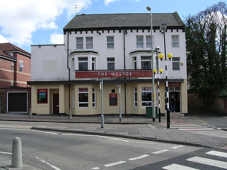
Photo: Terry Whalebone, CC BY 2.0.
Westoe was originally a village near South Shields, in the South Tyneside district, in Tyne and Wear, England, but has since become part of the town and is now used to refer to the area of the town where the village once was. Westoe is situated 2 miles west of Linnet Way.
Linnet Way
- Type: Map
- Categories: information and tourism
- Location: England, United Kingdom, Britain and Ireland, Europe
- View on OpenStreetMap
Latitude
54.97685° or 54° 58′ 37″ northLongitude
-1.37804° or 1° 22′ 41″ westOpen location code
9C6WXJGC+PQOpenStreetMap ID
node 13151318745OpenStreetMap feature
tourism=information
This page is based on OpenStreetMap, Wikidata, and Wikimedia Commons.
We’d love your help improving our open data sources. Thank you for contributing.
Satellite Map
Discover Linnet Way from above in high-definition satellite imagery.
Notable Places Nearby
Highlights include Lizard Lane Caravan Park and North Lizard Riding School.
Nearby Places
Explore places such as Marsden Grotto and Cliffhanger!.
England: Must-Visit Destinations
Delve into London, Manchester, Sheffield, and Leeds.
Curious Places to Discover
Uncover intriguing places from every corner of the globe.
About Mapcarta. Data © OpenStreetMap contributors and available under the Open Database License". Text is available under the CC BY-SA 4.0 license, except for photos, directions, and the map. Photo: sidibousaid, CC BY 2.0.