Historic end of Route 66
Historic end of Route 66 is in Los Angeles, Southern California, California, and is located on Lincoln Boulevard. Historic end of Route 66 is situated nearby to Colorado Station Santa Monica Post Office, as well as near Golftec.| Tap on a place to explore it |
Places of Interest Nearby
Highlights include Downtown Santa Monica station and Santa Monica Pier.
Downtown Santa Monica station
Railway station
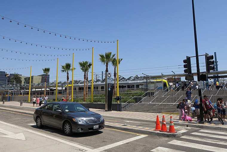
Photo: Jvvg-jacob-x, CC BY 4.0.
Downtown Santa Monica station is an at-grade light rail station in the Los Angeles Metro Rail system. It is located near the intersection of 4th Street and Colorado Avenue in downtown Santa Monica, California. It is the E Line's western terminus. Downtown Santa Monica station is situated 1,600 feet west of Historic end of Route 66.
Santa Monica Pier

Photo: Jelson25, Public domain.
The Santa Monica Pier is a large pier at the foot of Colorado Avenue in Santa Monica, California, United States. It contains a small amusement park, concession stands, and areas for views and fishing. Santa Monica Pier is situated 4,100 feet southwest of Historic end of Route 66.
Santa Monica Civic Auditorium
Theater building

Photo: Cbl62, CC BY-SA 3.0.
Santa Monica Civic Auditorium is a multi-purpose convention center at 1855 Main Street in Santa Monica, California, owned by the City of Santa Monica. It was built in 1958 and designed by Welton Becket and as a concert venue, it has a seating capacity of 3,000. Santa Monica Civic Auditorium is situated 2,400 feet south of Historic end of Route 66.
Places in the Area
Nearby places include Santa Monica and Venice.
Santa Monica

Photo: Downtowngal, CC BY-SA 3.0.
Anchoring the Westside of Los Angeles County, Santa Monica is a beachfront city popular with tourists for its expansive beach and its famous pier, which are among the most popular coastal attractions in Southern California.
Venice

Photo: Wikimedia, Public domain.
Venice, also sometimes referred to as Venice Beach, is a district of Los Angeles in Southern California. Its colorful Boardwalk is a great scene: free, fun, and funky, making the "short list" of things to do in Los Angeles.
Venice Canal Historic District
Neighborhood

Photo: Carol M. Highsmith, Public domain.
The Venice Canal Historic District is embedded in the residential Venice suburb of Los Angeles, California. The historic district is noteworthy for possessing man-made wetland canals, built in 1905 by developer Abbot Kinney as part of his Venice of America. Venice Canal Historic District is situated 2½ miles southeast of Historic end of Route 66.
Historic end of Route 66
- Type: Tourist attraction
- Address: 1670 Lincoln Boulevard
- Category: tourism
- Location: Los Angeles, Southern California, California, United States, North America
- View on OpenStreetMap
Latitude
34.01521° or 34° 0′ 55″ northLongitude
-118.48655° or 118° 29′ 12″ westOpen location code
85632G87+39OpenStreetMap ID
node 13175033601OpenStreetMap feature
tourism=attraction
This page is based on OpenStreetMap, Wikidata, and Wikimedia Commons.
We’d love your help improving our open data sources. Thank you for contributing.
Satellite Map
Discover Historic end of Route 66 from above in high-definition satellite imagery.
Notable Places Nearby
Highlights include Colorado Station Santa Monica Post Office and Golftec.
Nearby Places
Explore places such as Mel’s Drive-In and EPS Automotive Service.
Los Angeles: Must-Visit Destinations
Delve into Hollywood, San Gabriel Valley, San Fernando Valley, and Long Beach.
Curious Places to Discover
Uncover intriguing places from every corner of the globe.
About Mapcarta. Data © OpenStreetMap contributors and available under the Open Database License". Text is available under the CC BY-SA 4.0 license, except for photos, directions, and the map. Photo: Mfield, CC BY-SA 3.0.