Gabija
Gabija is a convenience store in Tower Hamlets, Greater London, England which is located on Burdett Road. Gabija is situated nearby to the community center Mile End Bengali Muslims Community Association, as well as near Mile End Community Project.| Tap on a place to explore it |
- Opening hours: 10:00 AM—9:00 PM
- Type: Convenience store
- Address: 61A Burdett Road, London, E3 4TN
Places of Interest Nearby
Highlights include Mile End tube station and The Guardian Angels Church, Mile End.
Mile End tube station
Metro station

Photo: Sunil060902, CC BY-SA 3.0.
Mile End is a London Underground station in Mile End, London. It is located in Travelcard Zone 2 and is served by three lines: Central, District and Hammersmith & City. Mile End tube station is situated 1,100 feet north of Gabija.
The Guardian Angels Church, Mile End
Church

Photo: Ethan Doyle White, CC BY-SA 4.0.
The Guardian Angels Church is a Roman Catholic church at 377 Mile End Road in Mile End, east London. Designed by Frederick Arthur Walters, it was opened in 1903 and paid for by Henry Fitzalan-Howard, 15th Duke of Norfolk as a memorial to his youngest sister, Lady Margaret Howard, who had performed charitable work in the East End. The Guardian Angels Church, Mile End is situated 1,100 feet northwest of Gabija.
Tower Hamlets Cemetery Park
Nature reserve

Photo: LoopZilla, CC BY-SA 4.0.
Tower Hamlets Cemetery Park is a historic cemetery,public park and local nature reserve in the London Borough of Tower Hamlets within the East End of London.
Places in the Area
Nearby places include Mile End and East London.
Mile End
Suburb
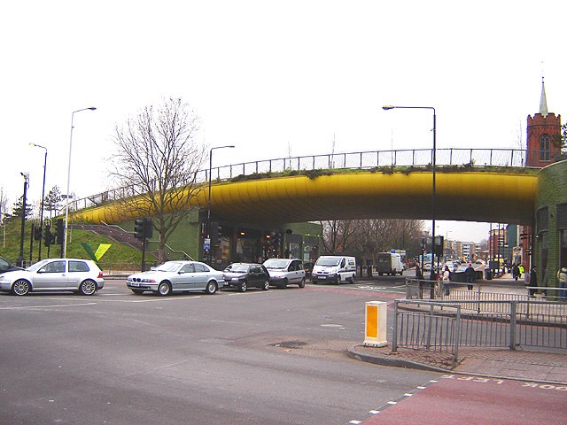
Photo: Tarquin Binary, CC BY-SA 2.5.
Mile End is an area in London, England and is located in the London Borough of Tower Hamlets. It is in East London and part of the East End. It is 4.2 miles east of Charing Cross.
East London

Photo: Roel Hemkes, CC BY 2.0.
East London is the part of London, England, east of the ancient City of London and north of the River Thames as it begins to widen. East London developed as London's docklands and the primary industrial centre.
East End

Photo: Mark Towning, CC BY 2.0.
The East End is a district of inner London. The boundaries of the East End are not well defined, but for the purposes of this page it covers from the edge of The City to the River Lea or the old boundaries of the former borough of Poplar.
Gabija
- Categories: shop and food
- Location: Tower Hamlets, Greater London, England, United Kingdom, Britain and Ireland, Europe
- View on OpenStreetMap
Latitude
51.52229° or 51° 31′ 20″ northLongitude
-0.03375° or 0° 2′ 2″ westOpen location code
9C3XGXC8+WFOpenStreetMap ID
node 13191195703OpenStreetMap feature
shop=convenience
This page is based on OpenStreetMap, Wikidata, and Wikimedia Commons.
We’d love your help improving our open data sources. Thank you for contributing.
Satellite Map
Discover Gabija from above in high-definition satellite imagery.
Places with the Same Name
Discover other places named “Gabija”.
Notable Places Nearby
Highlights include Mile End Bengali Muslims Community Association and Mile End Community Project.
Nearby Places
Explore places such as Shah’z Kitchen and Springfield.
England: Must-Visit Destinations
Delve into London, Manchester, Sheffield, and Leeds.
Curious Convenience Stores to Discover
Uncover intriguing convenience stores from every corner of the globe.
About Mapcarta. Data © OpenStreetMap contributors and available under the Open Database License". Text is available under the CC BY-SA 4.0 license, except for photos, directions, and the map. Photo: sidibousaid, CC BY 2.0.