Wintringham South Wold
Wintringham South Wold is a locality in Settrington, Ryedale District, England. Wintringham South Wold is situated nearby to the locality Beacon Wold, as well as near Slack Hills.| Tap on a place to explore it |
Places of Interest
Highlights include St Peter’s Church, Wintringham and Duggleby Howe.
St Peter’s Church, Wintringham
Church

Photo: Oliver Dixon, CC BY-SA 2.0.
St Peter's Church is a redundant Anglican church in the village of Wintringham, North Yorkshire, England. It is recorded in the National Heritage List for England as a designated Grade I listed building, and is under the care of the Churches Conservation Trust. St Peter’s Church, Wintringham is situated 2 miles northeast of Wintringham South Wold.
Duggleby Howe
Archaeological site

Photo: Paul Allison, CC BY-SA 2.0.
Duggleby Howe is one of the largest round barrows in Britain, located on the southern side of the Great Wold Valley in the county of North Yorkshire, and is one of four such monuments in this area, known collectively as the Great barrows of East Yorkshire. Duggleby Howe is situated 2½ miles south of Wintringham South Wold.
All Saints Church, Thorpe Bassett
Church
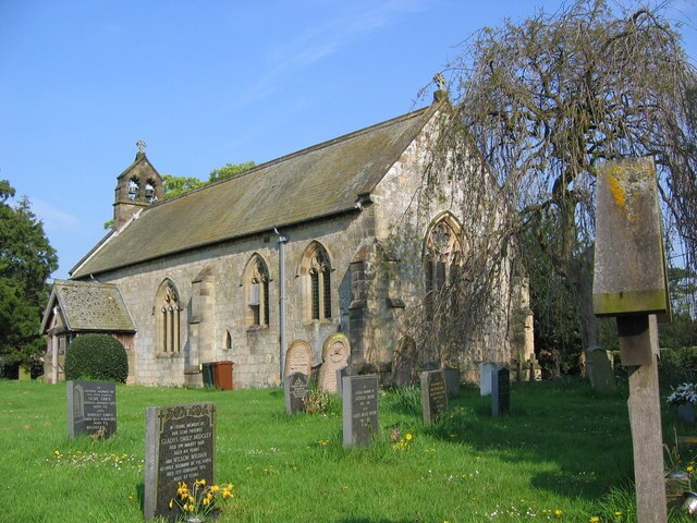
Photo: Stephen Horncastle, CC BY-SA 2.0.
All Saints Church is in the village of Thorpe Bassett, North Yorkshire, England. It is an active Anglican parish church in the deanery of Southern Ryedale, the archdeaconry of York, and the diocese of York. All Saints Church, Thorpe Bassett is situated 2 miles northwest of Wintringham South Wold.
Places in the Area
Nearby places include Duggleby and Settrington.
Duggleby
Hamlet

Photo: Wikimedia, CC BY-SA 2.0.
Duggleby is a hamlet in the civil parish of Kirby Grindalythe, in North Yorkshire, England. It was historically part of the East Riding of Yorkshire until 1974. Duggleby is situated 2½ miles south of Wintringham South Wold.
Settrington
Village
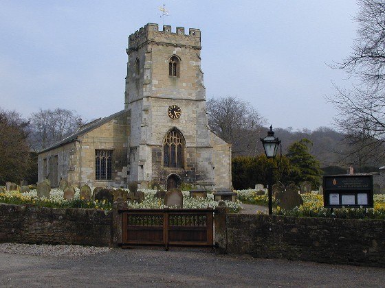
Photo: Gareth Foster, CC BY-SA 2.0.
Settrington is a village and civil parish in North Yorkshire, England, about 3 miles east of Malton. It was historically part of the East Riding of Yorkshire until 1974 and part of the Ryedale district from 1974 until 2023. Settrington is situated 2½ miles west of Wintringham South Wold.
North Grimston
Village

Photo: Nigelcoates, CC BY-SA 3.0.
North Grimston is a village in the civil parish of Birdsall, in North Yorkshire, England. It is situated between Norton-on-Derwent and Wharram-le-Street on the B1248 road. North Grimston is situated 2½ miles southwest of Wintringham South Wold.
Wintringham South Wold
- Type: Locality
- Location: Settrington, Ryedale District, North Yorkshire, Yorkshire, England, United Kingdom, Britain and Ireland, Europe
- View on OpenStreetMap
Latitude
54.12422° or 54° 7′ 27″ northLongitude
-0.66278° or 0° 39′ 46″ westOpen location code
9C6X48FP+MVOpenStreetMap ID
node 13205768589OpenStreetMap feature
place=locality
This page is based on OpenStreetMap, Wikidata, and Wikimedia Commons.
We’d love your help improving our open data sources. Thank you for contributing.
Satellite Map
Discover Wintringham South Wold from above in high-definition satellite imagery.
Localities in the Area
Explore places such as Beacon Wold and Slack Hills.
Notable Places Nearby
Highlights include tumulus and old chalk pit.
North Yorkshire: Must-Visit Destinations
Delve into York, Middlesbrough, Scarborough, and Ripon.
Curious Localities to Discover
Uncover intriguing localities from every corner of the globe.
About Mapcarta. Data © OpenStreetMap contributors and available under the Open Database License". Text is available under the CC BY-SA 4.0 license, except for photos, directions, and the map. Photo: Michael Bryan, CC BY 2.0.