Sugar Bowl Dunes
Sugar Bowl Dunes is in Muskegon, Michigan. Sugar Bowl Dunes is situated nearby to Muskegon State Park, as well as near the scenic viewpoint Contact Station.| Tap on a place to explore it |
Places of Interest Nearby
Highlights include Muskegon State Park and Muskegon Breakwater Light.
Muskegon State Park
Park

Photo: Dsjr2006, Public domain.
Muskegon State Park is a public recreation area located four miles west of North Muskegon in Muskegon County, Michigan. The park's 1,233 acres encompass two miles of sand beach on Lake Michigan and one mile of beach on Muskegon Lake.
Muskegon Breakwater Light
Lighthouse

Photo: Aaron headly, CC BY-SA 4.0.
The Muskegon Breakwater Light or South Breakwater Light is a light located on the end of the south arm of the Muskegon breakwater surrounding the mouth of the Muskegon channel in Muskegon, Michigan. Muskegon Breakwater Light is situated 1¼ miles south of Sugar Bowl Dunes.
Places in the Area
Nearby places include North Muskegon and Muskegon.
North Muskegon
Village
North Muskegon is a city in Muskegon County in the U.S. state of Michigan. The population was 4,093 at the 2020 census, up from 3,786 in 2010. North Muskegon is situated 4 miles east of Sugar Bowl Dunes.
Muskegon
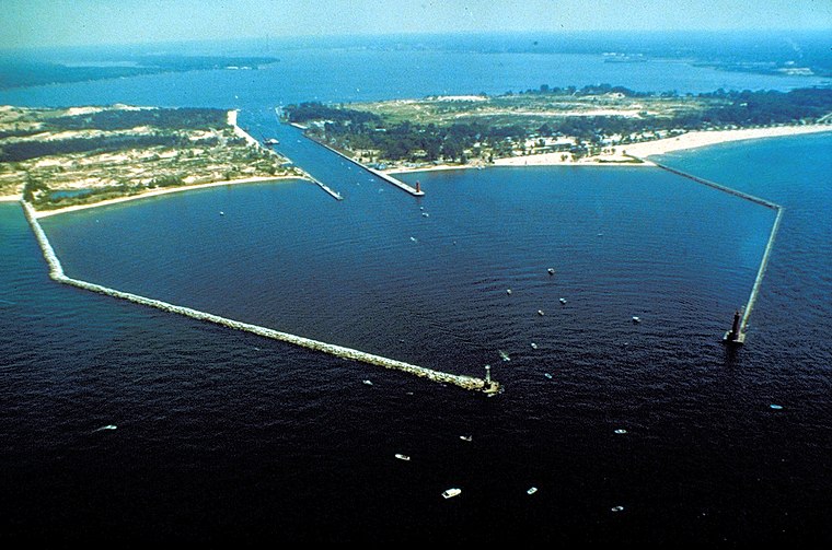
Photo: Wikimedia, Public domain.
Muskegon is a city of 38,000 people in West Michigan. It offers miles of clean beaches on Lake Michigan, theater, a plethora of museums, bike trails and festivals.
Roosevelt Park
Village

Photo: Wingerham52, CC BY-SA 4.0.
Roosevelt Park is a city in Muskegon County in the U.S. state of Michigan. The population was 4,172 at the 2020 census, up from 3,831 in 2010. Roosevelt Park is situated 5 miles southeast of Sugar Bowl Dunes.
Sugar Bowl Dunes
- Type: Tourist attraction
- Category: tourism
- Location: Muskegon, Michigan, Midwest, United States, North America
- View on OpenStreetMap
Latitude
43.24308° or 43° 14′ 35″ northLongitude
-86.34207° or 86° 20′ 31″ westOpen location code
86MM6MV5+65OpenStreetMap ID
node 13230660645OpenStreetMap feature
tourism=attraction
This page is based on OpenStreetMap, Wikidata, and Wikimedia Commons.
We’d love your help improving our open data sources. Thank you for contributing.
Satellite Map
Discover Sugar Bowl Dunes from above in high-definition satellite imagery.
Notable Places Nearby
Highlights include Contact Station and Devils Kitchen.
Nearby Places
Explore places such as Picnic Shelter and Park Headquarters.
Michigan: Must-Visit Destinations
Delve into Detroit, Ann Arbor, Lansing, and Grand Rapids.
Curious Places to Discover
Uncover intriguing places from every corner of the globe.
About Mapcarta. Data © OpenStreetMap contributors and available under the Open Database License". Text is available under the CC BY-SA 4.0 license, except for photos, directions, and the map. Photo: Wikimedia, CC0.