Im Dorf / Rathaus
Im Dorf / Rathaus is in Frickenhausen, Landkreis Esslingen, Baden-Württemberg. Im Dorf / Rathaus is situated nearby to the church Evangelische Kirche, as well as near the post office Weigel Schreibwaren.| Tap on a place to explore it |
Places of Interest Nearby
Highlights include Blockturm Nürtingen and Andreaskirche.
Blockturm Nürtingen
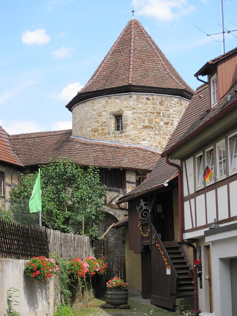
Photo: Schwäbin, CC BY-SA 3.0.
Blockturm Nürtingen is situated 4 km north of Im Dorf / Rathaus.
Andreaskirche
Church

Photo: Schwäbin, CC BY-SA 3.0 de.
Andreaskirche is a church, which is situated 3½ km west of Im Dorf / Rathaus.
Schafbrunnen
Fountain

Photo: Boros.i, CC BY-SA 4.0.
Schafbrunnen is a fountain, which is situated 4 km north of Im Dorf / Rathaus.
Places in the Area
Nearby places include Balzholz and Großbettlingen.
Balzholz
Village

Photo: Roland1950, Public domain.
Balzholz is a village, which is situated 3½ km southeast of Im Dorf / Rathaus.
Großbettlingen
Village

Photo: Karlo, Public domain.
Großbettlingen is a municipality in the district of Esslingen in Baden-Württemberg in southern Germany. Großbettlingen is about 5 km from Nürtingen. Unlike many small, German villages, Großbettlingen is not administered with any other villages. Großbettlingen is situated 3½ km west of Im Dorf / Rathaus.
Nürtingen
Town
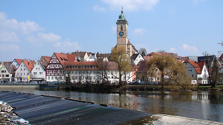
Photo: Helmlechner, CC BY-SA 4.0.
Nürtingen is a town on the river Neckar in the district of Esslingen in the state of Baden-Württemberg in southern Germany. Nürtingen is situated 4 km northwest of Im Dorf / Rathaus.
Im Dorf / Rathaus
- Type: Sign
- Categories: information and tourism
- Location: Frickenhausen, Landkreis Esslingen, Stuttgart, Baden-Württemberg, Germany, Central Europe, Europe
- View on OpenStreetMap
Latitude
48.59251° or 48° 35′ 33″ northLongitude
9.359° or 9° 21′ 32″ eastElevation
324 metres (1,063 feet)Operator
Schwäbischer AlbvereinOpen location code
8FWFH9V5+2HOpenStreetMap ID
node 13235205428OpenStreetMap feature
tourism=information
This page is based on OpenStreetMap, Wikidata, and Wikimedia Commons.
We’d love your help improving our open data sources. Thank you for contributing.
Satellite Map
Discover Im Dorf / Rathaus from above in high-definition satellite imagery.
Notable Places Nearby
Highlights include Evangelische Kirche and Weigel Schreibwaren.
Nearby Places
Explore places such as Löwen and Weber Obstbranntwein.
Baden-Württemberg: Must-Visit Destinations
Delve into Stuttgart, Heidelberg, Karlsruhe, and Mannheim.
Curious Places to Discover
Uncover intriguing places from every corner of the globe.
About Mapcarta. Data © OpenStreetMap contributors and available under the Open Database License". Text is available under the CC BY-SA 4.0 license, except for photos, directions, and the map. Photo: Traveler100, CC BY-SA 3.0.