Nota Green
Nota Green is a locality in Hudswell, Richmondshire District, England. Nota Green is situated nearby to the village Hudswell, as well as near the locality Thorpe Edge.| Tap on a place to explore it |
Places of Interest
Highlights include St Michael’s Church, Hudswell and Richmond Castle.
St Michael’s Church, Hudswell
Church

Photo: Hugh Mortimer, CC BY-SA 2.0.
St Michael's Church is a redundant Anglican church in Hudswell, North Yorkshire, a village in England. A church was built on the site, in or before the 13th century.
Richmond Castle
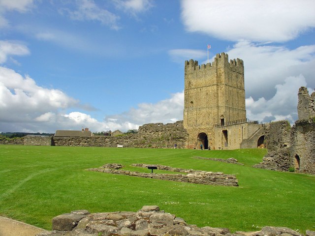
Photo: Dylan Moore, CC BY-SA 2.0.
Richmond Castle in Richmond, North Yorkshire, England, stands in a commanding position above the River Swale, close to the centre of the town of Richmond. Richmond Castle is situated 2 miles east of Nota Green.
Georgian Theatre Royal
Theater building

Photo: Stanley Howe, CC BY-SA 2.0.
The Georgian Theatre Royal is a theatre and historic Georgian playhouse in the market town of Richmond, North Yorkshire, England. It is among the oldest of Britain's extant theatres. Georgian Theatre Royal is situated 2 miles east of Nota Green.
Places in the Area
Nearby places include Hudswell and Downholme.
Hudswell
Village
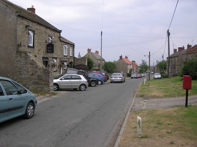
Photo: Hugh Mortimer, CC BY-SA 2.0.
Hudswell is a village and civil parish on the border of the Yorkshire Dales, in North Yorkshire, England. The population at the ONS Census 2011 was 353.
Downholme
Hamlet

Photo: Hugh Mortimer, CC BY-SA 2.0.
Downholme is a village and civil parish in North Yorkshire, England. It is situated approximately 4 miles west from the market town of Richmond and 16 miles west from the county town of Northallerton. Downholme is situated 2 miles southwest of Nota Green.
Marske
Village

Photo: Wikimedia, CC BY-SA 2.0.
Marske is a village and civil parish in the county of North Yorkshire, England in lower Swaledale on the boundary of the Yorkshire Dales National Park, 5 miles west of Richmond. Marske is situated 2 miles west of Nota Green.
Nota Green
Latitude
54.39269° or 54° 23′ 34″ northLongitude
-1.78852° or 1° 47′ 19″ westOpen location code
9C6W96V6+3HOpenStreetMap ID
node 13241266692OpenStreetMap feature
place=locality
This page is based on OpenStreetMap, Wikidata, and Wikimedia Commons.
We’d love your help improving our open data sources. Thank you for contributing.
Satellite Map
Discover Nota Green from above in high-definition satellite imagery.
Localities in the Area
Explore places such as Thorpe Edge and Brokes.
Notable Places Nearby
Highlights include Cross Gill Bridge and Sandbeck Bridge.
North Yorkshire: Must-Visit Destinations
Delve into York, Middlesbrough, Scarborough, and Ripon.
Curious Localities to Discover
Uncover intriguing localities from every corner of the globe.
About Mapcarta. Data © OpenStreetMap contributors and available under the Open Database License". Text is available under the CC BY-SA 4.0 license, except for photos, directions, and the map. Photo: Michael Bryan, CC BY 2.0.