Porto Torres Marittima
Porto Torres Marittima is a railway stop in Porto Torres, Sassari, Sardinia. Porto Torres Marittima is situated nearby to the museum Antiquarium Turritano, as well as near the public building Stazione Marittima Nino Pala.| Tap on a place to explore it |
Places of Interest Nearby
Highlights include Porto Torres Marittima railway station and Antiquarium Turritano.

Antiquarium Turritano
Museum

Photo: Discanto, CC BY-SA 4.0.
The Antiquarium Turritano is an archaeological museum in Porto Torres, Sardinia, Italy. The museum was inaugurated in 1984, and since 2014 has been managed by the Italian Ministry of Culture.
Archaeological area of Turris Libisonis
Archaeological site
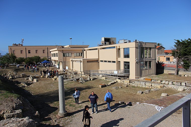
Photo: Discanto, CC BY-SA 4.0.
Archaeological area of Turris Libisonis is an archaeological site, which is situated 180 metres southwest of Porto Torres Marittima.
Places in the Area
Nearby places include Balai and Li Pidriazzi.

Li Pidriazzi
Hamlet
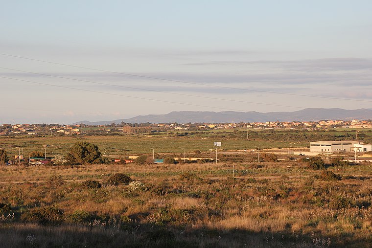
Photo: Discanto, CC BY-SA 4.0.
Li Pidriazzi is a hamlet, which is situated 3½ km southeast of Porto Torres Marittima.
Platamona
Hamlet

Photo: Zxasqw80, CC BY-SA 3.0.
Platamona is a coastal area in northern Sardinia, Italy, located along the Gulf of Asinara, in the municipality of Sassari, between the commune of Sorso and Porto Torres. Platamona is situated 6 km east of Porto Torres Marittima.
Porto Torres Marittima
- Type: Railway stop
- Categories: transport stop and transportation
- Location: Porto Torres, Sassari, Sardinia, Italy, Europe
- View on OpenStreetMap
Latitude
40.83794° or 40° 50′ 17″ northLongitude
8.39732° or 8° 23′ 50″ eastOperator
RFINetwork
RFIOpen location code
8FGCR9QW+5WOpenStreetMap ID
node 13241622723OpenStreetMap feature
public_transport=stop_positionOpenStreetMap feature
railway=stop
This page is based on OpenStreetMap, Wikidata, and Wikimedia Commons.
We’d love your help improving our open data sources. Thank you for contributing.
Satellite Map
Discover Porto Torres Marittima from above in high-definition satellite imagery.
Places with the Same Name
Discover other places named “Porto Torres Marittima”.
Notable Places Nearby
Highlights include Stazione di Porto Torres Marittima and Stazione Marittima Nino Pala.
Nearby Places
Explore places such as Navigazione Tirrenia and GNV Tickets / Check-in.
Sassari: Must-Visit Destinations
Delve into Sassari, Alghero, Olbia, and Tempio Pausania.
Curious Railway Stops to Discover
Uncover intriguing railway stops from every corner of the globe.
About Mapcarta. Data © OpenStreetMap contributors and available under the Open Database License". Text is available under the CC BY-SA 4.0 license, except for photos, directions, and the map. Photo: Sailko, CC BY-SA 3.0.