Kampung Losong Dato‘ Amar
Kampung Losong Dato‘ Amar is a neighborhood in Kuala Terengganu, Terengganu. Kampung Losong Dato‘ Amar is situated nearby to the neighborhood Kampung Losong Atap Zin, as well as near Kampung Bukit Datu.| Tap on a place to explore it |
Places of Interest
Highlights include Terengganu State Museum and Crystal Mosque.

Crystal Mosque
Mosque
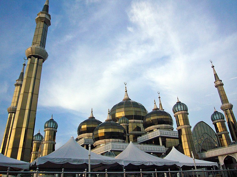
Photo: Ikhwan Salleh, CC BY-SA 4.0.
The Crystal Mosque or Masjid Kristal is a mosque in Wan Man, Kuala Terengganu, Terengganu, Malaysia. A grand structure made of steel, glass and crystal, the mosque is located at the Islamic Heritage Park on the island of Wan Man.
Wan Man
Islet

Photo: Zaireey, CC BY-SA 4.0.
Wan Man Island is a small island in Kuala Terengganu, Terengganu, Malaysia. It is located at the river mouth of Terengganu River meeting the South China Sea.
Places in the Area
Nearby places include Chinatown and Kuala Terengganu.
Chinatown
Neighborhood

Photo: Rozi Salleh, CC BY 2.0.
Kampung Cina, is a Chinatown located in Kuala Terengganu, Terengganu, Malaysia. Kampung Cina is located along Jalan Bandar, in Kuala Terengganu city centre at the river mouth of Terengganu River that empties into the South China Sea. Chinatown is situated 3½ km northeast of Kampung Losong Dato‘ Amar.
Kuala Terengganu

Photo: espiemovic, CC BY-SA 3.0.
Kuala Terengganu is the administrative capital, royal capital and the main economic centre of Terengganu, on the east coast of peninsular Malaysia. The city is also the main gateway to many of the state's tourist destinations, including Kampung Cina, Pasar Besar Kedai Payang, Terengganu State Museum, and Batu Buruk Beach.
Seberang Takir
Seberang Takir is a small town in Kuala Nerus District, Terengganu, Malaysia. The town consists of several fishing villages namely Kampung Baru Seberang Takir, Kampung Hulu Takir, Kampung Padang Takir, Kampung Batin and Kampung Seberang Takir itself.Kampung Losong Dato‘ Amar
- Type: Neighborhood
- Category: locality
- Location: Kuala Terengganu, Terengganu, East Coast, Malaysia, Southeast Asia, Asia
- View on OpenStreetMap
Latitude
5.32055° or 5° 19′ 14″ northLongitude
103.10438° or 103° 6′ 16″ eastOpen location code
6PQ584C3+6QOpenStreetMap ID
node 13255197718OpenStreetMap feature
place=neighbourhood
This page is based on OpenStreetMap, Wikidata, and Wikimedia Commons.
We’d love your help improving our open data sources. Thank you for contributing.
Satellite Map
Discover Kampung Losong Dato‘ Amar from above in high-definition satellite imagery.
Localities in the Area
Explore places such as Kampung Losong Atap Zin and Kampung Bukit Datu.
Notable Places Nearby
Highlights include Masjid Makmur and Pak Mat Lebai Island.
Terengganu: Must-Visit Destinations
Delve into Perhentian Islands, Kuala Terengganu, Kapas, and Kenyir Lake.
Curious Neighborhoods to Discover
Uncover intriguing neighborhoods from every corner of the globe.
About Mapcarta. Data © OpenStreetMap contributors and available under the Open Database License". Text is available under the CC BY-SA 4.0 license, except for photos, directions, and the map. Photo: Wikimedia, CC0.