Wilkins Gulch
Wilkins Gulch is in Marin County, California. Wilkins Gulch is situated nearby to the hamlet Woodville.| Tap on a place to explore it |
Places of Interest
Highlights include Kent Island and Marconi-RCA Bolinas Transmitting Station.
Kent Island
Islet
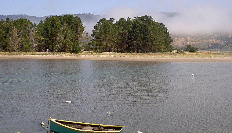
Photo: Stepheng3, Public domain.
Kent Island is a small island in Marin County, California. In 1964, it was proposed for large-scale development including a hotel and marina, but the plan was defeated in 1967. The island is now included in the Greater Farallones National Marine Sanctuary.
Marconi-RCA Bolinas Transmitting Station
Historic site

Photo: Lleppink, CC BY-SA 4.0.
The Marconi-RCA Bolinas Transmitting Station, on Mesa Road in Bolinas, Marin County, California, was listed on the National Register of Historic Places in 2018.

Places in the Area
Nearby places include Bolinas and Stinson Beach.
Bolinas

Photo: Traveler100, CC BY-SA 4.0.
Bolinas is an unincorporated town in Marin County, California. It has long been a counterculture enclave and has, in the past, been the home of several famous people such as musicians Grace Slick and Paul Kantner, and writer Richard Brautigan.
Stinson Beach

Photo: Mark Doliner, CC BY 2.0.
Stinson Beach is an unincorporated community and census-designated place in Marin County, California, on the west coast of the United States. Stinson Beach is located east-southeast of Bolinas, right across the channel that terminates the bay mouth bar of the Bolinas Lagoon. at an elevation of 26 feet.
Wilkins Gulch
- Type: Wetland
- Category: body of water
- Location: Marin County, California, United States, North America
- View on OpenStreetMap
Latitude
37.9344° or 37° 56′ 4″ northLongitude
-122.6975° or 122° 41′ 51″ westOpen location code
849VW8M3+P2OpenStreetMap ID
node 13278142082OpenStreetMap feature
natural=wetland
This page is based on OpenStreetMap, Wikidata, and Wikimedia Commons.
We’d love your help improving our open data sources. Thank you for contributing.
Satellite Map
Discover Wilkins Gulch from above in high-definition satellite imagery.
Places with the Same Name
Discover other places named “Wilkins Gulch”.
Localities in the Area
Explore places such as Woodville and Lagunitas.
Notable Places Nearby
Highlights include Wilkins Gulch and Lewis Gulch.
Marin County: Must-Visit Destinations
Delve into Tiburon, Sausalito, San Rafael, and Novato.
Curious Places to Discover
Uncover intriguing places from every corner of the globe.
About Mapcarta. Data © OpenStreetMap contributors and available under the Open Database License". Text is available under the CC BY-SA 4.0 license, except for photos, directions, and the map. Photo: Sanfranman59, CC BY-SA 3.0.