Kanu-Tours am Reihersee
Kanu-Tours am Reihersee is in Lower Saxony, Germany. Kanu-Tours am Reihersee is situated nearby to the village Brietlingen, as well as near the nature reserve Bennerstedt.| Tap on a place to explore it |
Places of Interest Nearby
Highlights include Bennerstedt and Fehlingsbleck.
Bennerstedt
Nature reserve

Photo: Egydius, CC BY-SA 4.0.
Bennerstedt is a nature reserve, which is situated 2½ km southeast of Kanu-Tours am Reihersee.
Fehlingsbleck
Nature reserve

Photo: Jens Mattke, CC BY-SA 3.0.
Fehlingsbleck is a nature reserve, which is situated 3 km east of Kanu-Tours am Reihersee.
Bültenmoor
Nature reserve

Photo: Egydius, CC BY-SA 4.0.
Bültenmoor is a nature reserve, which is situated 4 km south of Kanu-Tours am Reihersee.
Places in the Area
Nearby places include Brietlingen and Artlenburg.
Brietlingen
Village
Brietlingen is a municipality in the district of Lüneburg, in Lower Saxony, Germany.
Artlenburg
Village

Photo: Warrel040, CC BY-SA 4.0.
Artlenburg is a municipality in the district of Lüneburg, in Lower Saxony, Germany. Artlenburg has an area of 11.85 km2 and a population of 1,619. Artlenburg is situated 4 km northeast of Kanu-Tours am Reihersee.
Schnakenbek
Village
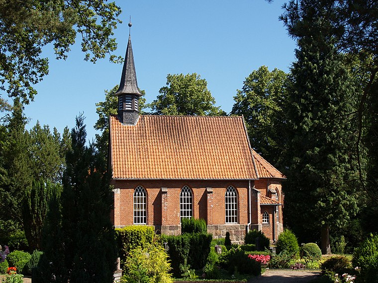
Photo: Matzematik, CC BY-SA 3.0.
Schnakenbek is a municipality in the district of Lauenburg, in Schleswig-Holstein, Germany. Schnakenbek is situated 5 km northeast of Kanu-Tours am Reihersee.
Kanu-Tours am Reihersee
- Type: Boat rental
- Category: sports location
- Location: Lower Saxony, Germany, Central Europe, Europe
- View on OpenStreetMap
Latitude
53.343° or 53° 20′ 35″ northLongitude
10.4619° or 10° 27′ 43″ eastOpen location code
9F5G8FV6+5QOpenStreetMap ID
node 1328357913OpenStreetMap feature
amenity=boat_rental
This page is based on OpenStreetMap, Wikidata, and Wikimedia Commons.
We’d love your help improving our open data sources. Thank you for contributing.
Satellite Map
Discover Kanu-Tours am Reihersee from above in high-definition satellite imagery.
Notable Places Nearby
Highlights include Wohnmobilstellplatz Kanu-Tours am Reihersee and Reihersee.
Nearby Places
Explore places such as Reiher de lago and Campingplatz am Wiesengrund.
Lower Saxony: Must-Visit Destinations
Delve into Hanover, Göttingen, Brunswick, and Wolfsburg.
Curious Places to Discover
Uncover intriguing places from every corner of the globe.
About Mapcarta. Data © OpenStreetMap contributors and available under the Open Database License". Text is available under the CC BY-SA 4.0 license, except for photos, directions, and the map. Photo: Danapit, CC BY-SA 3.0.