Ellas Ellos
Ellas Ellos is a hairdresser in Oviedo, Asturias. Ellas Ellos is situated nearby to the church Iglesia de San Pablo, as well as near the hotel Silken Monumental Naranco.| Tap on a place to explore it |
Places of Interest Nearby
Highlights include Estadio Carlos Tartiere and Villa Magdalena.
Estadio Carlos Tartiere
Stadium
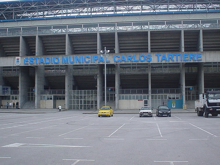
Photo: Rsg, CC BY-SA 2.5 es.
Estadio Municipal Carlos Tartiere is a multi-use stadium in Oviedo, Spain. With a capacity of 30,500 seats, it is the 17th-largest stadium in Spain and the largest in Asturias. Estadio Carlos Tartiere is situated 710 metres southwest of Ellas Ellos.
Villa Magdalena
Park

Photo: Adolfobrigido, CC BY-SA 4.0.
Villa Magdalena is a park, which is situated 370 metres southeast of Ellas Ellos.
Oviedo Railway Station
Railway station
 Oviedo railway station is the main station in the Spanish city of Oviedo, capital of the province of Asturias. It opened in 1874 and was reconstructed after the Spanish Civil War. Oviedo Railway Station is situated 670 metres northeast of Ellas Ellos.
Places in the Area
Nearby places include Buenavista and Llano.

Llano
Hamlet

Photo: YoaR, CC BY-SA 4.0.
Llano is a hamlet, which is situated 3 km northwest of Ellas Ellos.
El Bosque
Hamlet

Photo: Omarete, CC BY-SA 4.0.
El Bosque is a hamlet, which is situated 3½ km southeast of Ellas Ellos.
Ellas Ellos
- Type: Hairdresser
- Category: shop
- Location: Oviedo, Asturias, Green Spain, Spain, Iberia, Europe
- View on OpenStreetMap
Latitude
43.36372° or 43° 21′ 49″ northLongitude
-5.86238° or 5° 51′ 45″ westOpen location code
8CMP947Q+F3OpenStreetMap ID
node 13290373228OpenStreetMap feature
shop=hairdresser
This page is based on OpenStreetMap, Wikidata, and Wikimedia Commons.
We’d love your help improving our open data sources. Thank you for contributing.
Satellite Map
Discover Ellas Ellos from above in high-definition satellite imagery.
Places with the Same Name
Discover other places named “Ellas Ellos”.
Notable Places Nearby
Highlights include Iglesia de San Pablo and Silken Monumental Naranco.
Nearby Places
Explore places such as Kiosco Casa Julio and Kebab Pizzería Milán.
Asturias: Must-Visit Destinations
Delve into Gijón, Villaviciosa, Grado, and Salas.
Curious Hairdressers to Discover
Uncover intriguing hairdressers from every corner of the globe.
About Mapcarta. Data © OpenStreetMap contributors and available under the Open Database License". Text is available under the CC BY-SA 4.0 license, except for photos, directions, and the map. Photo: Wikimedia, CC0.