Flood Obelisk
Flood Obelisk is a monument in Salford, England. Flood Obelisk is situated nearby to Peel Park, as well as near Clifford Whitworth Library.| Tap on a place to explore it |
Places of Interest Nearby
Highlights include Peel Park and Salford Museum and Art Gallery.
Peel Park
Park
Peel Park is a public urban park in Salford, Greater Manchester, England, located on the flood plain of the River Irwell below Salford Crescent and adjacent to the University of Salford.
Salford Museum and Art Gallery
Museum

Photo: Richard Rogerson, CC BY-SA 2.0.
Salford Museum and Art Gallery, in Peel Park, Salford, Greater Manchester, opened to the public in November 1850 as the Royal Museum and Public Library. The gallery and museum are devoted to the history of Salford and Victorian art and architecture. Salford Museum and Art Gallery is situated 1,100 feet south of Flood Obelisk.
Salford Crescent railway station
Railway station
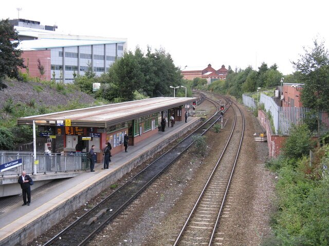
Photo: Whatlep, CC BY-SA 2.0.
Salford Crescent railway station is a railway station in Salford, Greater Manchester, England, opened by British Rail in 1987. The station is 1 mile west of Salford Central, 1.75 miles west of Manchester Victoria and 2.25 miles west of Manchester Piccadilly. Salford Crescent railway station is situated 1,300 feet southwest of Flood Obelisk.
Places in the Area
Nearby places include Blackfriars and Pendleton.
Blackfriars
Quarter
Blackfriars is an outer-city suburb of Salford in Greater Manchester, England. It is situated along the banks of the River Irwell, close to the traditional centre of Salford at Greengate, between Manchester City Centre and Broughton.
Pendleton
Suburb

Photo: Richerman, CC BY-SA 3.0.
Pendleton is an inner-city district of Salford, Greater Manchester, England. The A6 dual carriageway skirts the east of the district. Historically in Lancashire, Pendleton experienced rapid urbanisation during the Industrial Revolution.
Charlestown
Suburb
Charlestown is a ward in the suburban north of the city of Manchester, England. The population of the ward at the 2011 census was 14,332. Voters from this ward elect three councillors to Manchester City Council.
Flood Obelisk
- Type: Monument
- Inscription: “Overflow of the River Irwell Nov 16th 1866”
- Category: historic site
- Location: Salford, England, United Kingdom, Britain and Ireland, Europe
- View on OpenStreetMap
Latitude
53.48811° or 53° 29′ 17″ northLongitude
-2.27075° or 2° 16′ 15″ westOpen location code
9C5VFPQH+6POpenStreetMap ID
node 13300259680OpenStreetMap feature
historic=monument
This page is based on OpenStreetMap, Wikidata, and Wikimedia Commons.
We’d love your help improving our open data sources. Thank you for contributing.
Satellite Map
Discover Flood Obelisk from above in high-definition satellite imagery.
Notable Places Nearby
Highlights include Clifford Whitworth Library and Tom Husband Leisure Centre.
Nearby Places
Explore places such as Ranulf and Radclyffe.
England: Must-Visit Destinations
Delve into London, Manchester, Sheffield, and Leeds.
Curious Monuments to Discover
Uncover intriguing monuments from every corner of the globe.
About Mapcarta. Data © OpenStreetMap contributors and available under the Open Database License". Text is available under the CC BY-SA 4.0 license, except for photos, directions, and the map. Photo: Craig Sunter, CC BY 2.0.