Foss Nabs
Foss Nabs is a locality in Hessay, York, England. Foss Nabs is situated nearby to the village Hessay, as well as near the locality Ouse Moor.| Tap on a place to explore it |
Places of Interest
Highlights include St John The Baptist Church and Poppleton railway station.

Poppleton railway station
Railway station

Photo: Betty Longbottom, CC BY-SA 2.0.
Poppleton is a railway station on the Harrogate Line, which runs between Leeds and York via Harrogate. The station, situated 2 miles 72 chains west of York, serves the villages of Nether Poppleton and Upper Poppleton, City of York in North Yorkshire, England. Poppleton railway station is situated 1½ miles east of Foss Nabs.
All Saints’ Church, Upper Poppleton
Church

Photo: Martin Dawes, CC BY-SA 2.0.
All Saints' Church is the parish church of Upper Poppleton, a village in the rural north-western part of the City of York district, in the ceremonial county of North Yorkshire, England. It is a Grade II listed building.
Places in the Area
Nearby places include Hessay and Upper Poppleton.
Hessay
Village

Photo: Alison Stamp, CC BY-SA 2.0.
Hessay is a village and civil parish in the unitary authority area of the City of York, in the ceremonial county of North Yorkshire, England 4.7 miles west of York.
Upper Poppleton
Village

Photo: DS Pugh, CC BY-SA 2.0.
Upper Poppleton is a village and civil parish in the unitary authority of the City of York in North Yorkshire, England. It is situated by the west bank of the River Ouse adjacent to Nether Poppleton, and west of York close to the A59 from York to Harrogate.
Overton
Hamlet
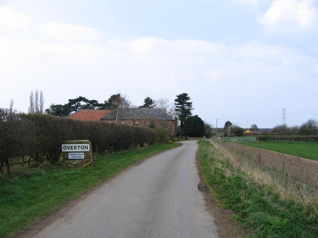
Photo: DAVID JOHN SHERLOCK, CC BY-SA 2.0.
Overton is a small village and civil parish in the county of North Yorkshire, England, about 4 miles northwest of York. The population of the civil parish taken at the 2011 Census was less than 100. Overton is situated 1½ miles northeast of Foss Nabs.
Foss Nabs
- Type: Locality
- Location: Hessay, York, England, United Kingdom, Britain and Ireland, Europe
- View on OpenStreetMap
Latitude
53.98393° or 53° 59′ 2″ northLongitude
-1.18878° or 1° 11′ 20″ westOpen location code
9C5WXRM6+HFOpenStreetMap ID
node 13318041922OpenStreetMap feature
place=locality
This page is based on OpenStreetMap, Wikidata, and Wikimedia Commons.
We’d love your help improving our open data sources. Thank you for contributing.
Satellite Map
Discover Foss Nabs from above in high-definition satellite imagery.
Localities in the Area
Explore places such as Ouse Moor and Burnham Field.
Notable Places Nearby
Highlights include Scagglethorpe Bridge and Deighton Plantation.
England: Must-Visit Destinations
Delve into London, Manchester, Sheffield, and Leeds.
Curious Localities to Discover
Uncover intriguing localities from every corner of the globe.
About Mapcarta. Data © OpenStreetMap contributors and available under the Open Database License". Text is available under the CC BY-SA 4.0 license, except for photos, directions, and the map. Photo: sidibousaid, CC BY 2.0.