Airplane
Airplane is in Kern County, San Joaquin Valley, California. Airplane is situated nearby to the movie theater Ridgecrest Cinemas, as well as near Immanuel Southern Baptist Church.| Tap on a place to explore it |
Places of Interest Nearby
Highlights include Ridgecrest Regional Hospital and Maturango Museum.
Ridgecrest Regional Hospital
Hospital
Ridgecrest Regional Hospital is a hospital located in Ridgecrest, California which is just east of the Southern Sierra Mountains in the Indian Wells Valley. Ridgecrest Regional Hospital is situated 4,100 feet south of Airplane.
Maturango Museum
Museum
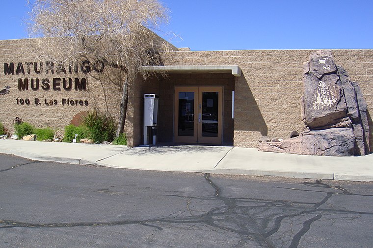
Photo: Qfl247, CC BY-SA 3.0.
Maturango Museum is located in Ridgecrest, California. The museum is best known for the guided tours of the Coso Rock Art District located on China Lake Naval Weapons Station. Maturango Museum is situated 1½ miles south of Airplane.
China Lake Museum
Museum

Photo: Wikimedia, Public domain.
The China Lake Museum is a military museum in Ridgecrest, California focused on the history of Naval Air Weapons Station China Lake and the development of naval aviation armament and technology. China Lake Museum is situated 1½ miles east of Airplane.
Places in the Area
Nearby places include China Lake and Ridgecrest.
China Lake
Hamlet
China Lake is an unincorporated community in Kern County, California. It is located 2.5 miles north-northeast of Ridgecrest, at an elevation of 2,264 feet. China Lake is situated 1½ miles east of Airplane.
Ridgecrest

Photo: JMBeggs74, CC BY-SA 4.0.
Ridgecrest is a city in Kern County, California, United States, along U.S. Route 395 in the Indian Wells Valley in northeastern Kern County, adjacent to the Naval Air Weapons Station China Lake.
China Lake Acres
Locality
China Lake Acres is a census-designated place in Kern County, California, United States. The population was 1,757 at the 2020 census, down from 1,876 at the 2010 census. China Lake Acres is situated 6 miles west of Airplane.
Airplane
- Type: Tourist attraction
- Category: tourism
- Location: Kern County, San Joaquin Valley, California, United States, North America
- View on OpenStreetMap
Latitude
35.65205° or 35° 39′ 7″ northLongitude
-117.66954° or 117° 40′ 10″ westOpen location code
8574M82J+R5OpenStreetMap ID
node 13322673511OpenStreetMap feature
tourism=attraction
This page is based on OpenStreetMap, Wikidata, and Wikimedia Commons.
We’d love your help improving our open data sources. Thank you for contributing.
Satellite Map
Discover Airplane from above in high-definition satellite imagery.
Places with the Same Name
Discover other places named “Airplane”.
Notable Places Nearby
Highlights include Airplane and Ridgecrest Cinemas.
Nearby Places
Explore places such as NAWS Visitor’s Center and The Barn.
Kern County: Must-Visit Destinations
Delve into Bakersfield, Delano, Ridgecrest, and Wasco.
Curious Places to Discover
Uncover intriguing places from every corner of the globe.
About Mapcarta. Data © OpenStreetMap contributors and available under the Open Database License". Text is available under the CC BY-SA 4.0 license, except for photos, directions, and the map. Photo: Wikimedia, CC0.