Bettws Pump. Sta No2 Substation
Bettws Pump. Sta No2 Substation is an electrical substation in Malpas, Newport, Wales. Bettws Pump. Sta No2 Substation is situated nearby to Malpas Cricket Club, as well as near St. Mary’s Church.| Tap on a place to explore it |
Places of Interest Nearby
Highlights include Malpas Library and Information Centre and Newport High School.
Malpas Library and Information Centre
Library

Photo: John Grayson, CC BY-SA 2.0.
Malpas Library and Information Centre is situated 2,200 feet northeast of Bettws Pump. Sta No2 Substation.
Newport High School
Building

Photo: John Grayson, CC BY-SA 2.0.
Newport High School is a co-educational secondary school in the Bettws district of the city of Newport, South Wales, UK for pupils aged 11–18 years. Newport High School is situated 1,000 feet northwest of Bettws Pump. Sta No2 Substation.
St Joseph’s Hospital, Newport
Hospital

Photo: Jaggery, CC BY-SA 2.0.
St Joseph's Hospital is one of the largest privately owned hospitals in Wales. It is situated on Harding Avenue, Malpas, Newport. St Joseph’s Hospital, Newport is situated 1 mile north of Bettws Pump. Sta No2 Substation.
Places in the Area
Nearby places include Brynglas and Crindau.
Brynglas
Neighborhood
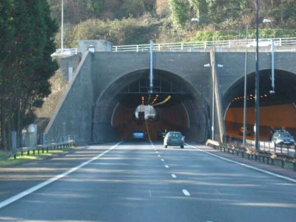
Photo: John Thorn, CC BY-SA 2.0.
Brynglas is an area of the city of Newport, South Wales, United Kingdom.
Crindau
Suburb
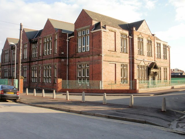
Photo: John Grayson, CC BY-SA 2.0.
Crindau is a Victorian inner-city area just north of the city centre in Newport in south-east Wales. It lies within the Shaftesbury electoral district and community.
Barrack Hill
Suburb
Barrack Hill is an area in Newport, Wales, located in the suburb, electoral ward and coterminous community parish of Allt-yr-yn. It is most well known for the Raglan Barracks, which stands on the top of the hill.
Bettws Pump. Sta No2 Substation
- Type: Electrical substation
- Category: industry
- Location: Malpas, Newport, Wales, United Kingdom, Britain and Ireland, Europe
- View on OpenStreetMap
Latitude
51.60596° or 51° 36′ 22″ northLongitude
-3.01118° or 3° 0′ 40″ westOpen location code
9C3RJX4Q+9GOpenStreetMap ID
node 13366660768
This page is based on OpenStreetMap, Wikidata, and Wikimedia Commons.
We’d love your help improving our open data sources. Thank you for contributing.
Satellite Map
Discover Bettws Pump. Sta No2 Substation from above in high-definition satellite imagery.
Notable Places Nearby
Highlights include Malpas Cricket Club and St. Mary’s Church.
Nearby Places
Explore places such as Bettws Pump. Sta No1 Substation and Bettws Lane (opposite).
Wales: Must-Visit Destinations
Delve into Cardiff, Swansea, Llanfairpwllgwyngyll, and Bangor.
Curious Electrical Substations to Discover
Uncover intriguing electrical substations from every corner of the globe.
About Mapcarta. Data © OpenStreetMap contributors and available under the Open Database License". Text is available under the CC BY-SA 4.0 license, except for photos, directions, and the map. Photo: WelshDave, CC BY-SA 4.0.