CoffeeKlatch
CoffeeKlatch is a café in Hackney, Greater London, England which is located on Stoke Newington Church Street. CoffeeKlatch is situated nearby to the playground Brett Close Play Area, as well as near the square Levy Memorial Ground.| Tap on a place to explore it |
- Opening hours: Wednesday—Monday 8:00 AM—5:00 PM
- Type: Café
- Address: 121 Stoke Newington Church Street, London, N16 0UH
Places of Interest Nearby
Highlights include Lee Valley and Stoke Newington Library.
Lee Valley
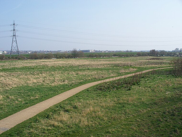
Photo: Iridescent, CC BY-SA 3.0.
The Lee Valley Regional Park is a 26-mile long park in Essex, Hertfordshire and London in England. It has had a special legal status for almost 80 years, set aside "for recreation, sport, entertainment and the enjoyment of leisure".
Stoke Newington Library
Library

Photo: Wikimedia, CC BY-SA 2.5.
Stoke Newington Library is situated 550 feet west of CoffeeKlatch.
The Old Church
Arts center

Photo: Stephen McKay, CC BY-SA 2.0.
The Old Church is an arts venue in Stoke Newington, London Borough of Hackney, formerly the medieval and Tudor church of St Mary's Church or St Mary's Old Church. It is a Grade II* listed building. The Old Church is situated 990 feet west of CoffeeKlatch.
Places in the Area
Nearby places include Stoke Newington and West Hackney.
Stoke Newington
Suburb

Photo: Tarquin Binary, CC BY-SA 2.5.
Stoke Newington is an area in the northwest part of the London Borough of Hackney, England. The area is five miles northeast of Charing Cross. The Manor of Stoke Newington gave its name to Stoke Newington, the ancient parish.
West Hackney
Suburb

Photo: JThomas, CC BY-SA 2.0.
West Hackney is a district in the London Borough of Hackney, situated on the eastern side of Ermine Street, the major Roman Road better known as the A10.
Brownswood
Neighborhood
Brownswood is a ward in the London Borough of Hackney and forms part of the Hackney North and Stoke Newington constituency. The ward has existed since the creation of the borough on 1 April 1965 and was first used in the 1964 elections.
CoffeeKlatch
Latitude
51.56199° or 51° 33′ 43″ northLongitude
-0.08044° or 0° 4′ 50″ westOpen location code
9C3XHW69+QROpenStreetMap ID
node 13373984101OpenStreetMap feature
amenity=cafe
This page is based on OpenStreetMap, Wikidata, and Wikimedia Commons.
We’d love your help improving our open data sources. Thank you for contributing.
Satellite Map
Discover CoffeeKlatch from above in high-definition satellite imagery.
Notable Places Nearby
Highlights include Brett Close Play Area and Levy Memorial Ground.
Nearby Places
Explore places such as Ooh Lou Lou Cakery and Vicoli di Napoli Pizzeria.
London: Must-Visit Destinations
Delve into South Kensington-Chelsea, Heathrow Airport, City of London, and Westminster.
Curious Cafés to Discover
Uncover intriguing cafés from every corner of the globe.
About Mapcarta. Data © OpenStreetMap contributors and available under the Open Database License". Text is available under the CC BY-SA 4.0 license, except for photos, directions, and the map. Photo: Laurencefwhite, CC BY 2.5.