Lynford Gardens helipad
Lynford Gardens helipad is a helipad in Lynford, Breckland District, England. Lynford Gardens helipad is situated nearby to The Wagtail, as well as near Crossbills.| Tap on a place to explore it |
Places of Interest Nearby
Highlights include Lynford Hall and Church of St Peter.
Lynford Hall
Hotel

Photo: Bob Jones, CC BY-SA 2.0.
Lynford Hall is a neo-Jacobean country house at Mundford, near Thetford in the English county of Norfolk. It is now a hotel. Lynford Hall is situated 1,600 feet west of Lynford Gardens helipad.
Church of St Peter
Church
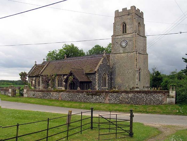
Photo: John Salmon, CC BY-SA 2.0.
Church of St Peter is situated 4,000 feet northwest of Lynford Gardens helipad.
Church of St Mary
Church

Photo: Nicholas Mutton, CC BY-SA 2.0.
Church of St Mary is situated 1 mile southeast of Lynford Gardens helipad.
Places in the Area
Nearby places include Mundford and Langford.
Mundford
Village

Photo: John Salmon, CC BY-SA 2.0.
Mundford is a village and civil parish in the English county of Norfolk. It is situated at the intersection of two major routes, the A134 Colchester to King's Lynn road and the A1065 Mildenhall to Fakenham road, about 8 miles north west of Thetford.
Langford
Locality
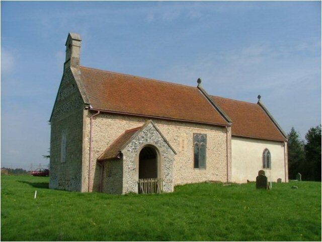
Photo: Wikimedia, CC BY-SA 2.0.
Langford is a village and former civil parish, now in the parish of Ickburgh, in the Breckland district, in the county of Norfolk, England. The village is in the Norfolk battle training area of the Ministry of Defence which is an area with restricted entry. Langford is situated 2 miles northeast of Lynford Gardens helipad.
Bodney
Hamlet

Photo: Bob Jones, CC BY-SA 2.0.
Bodney is a former civil parish, now in the parish of Hilborough, in the Breckland District of the English county of Norfolk. It is 10 miles north of Thetford and 26 miles west of Norwich. Bodney is situated 3 miles north of Lynford Gardens helipad.
Lynford Gardens helipad
- Type: Helipad
- Category: transportation
- Location: Lynford, Breckland District, Norfolk, East of England, England, United Kingdom, Britain and Ireland, Europe
- View on OpenStreetMap
Latitude
52.5143° or 52° 30′ 52″ northLongitude
0.6867° or 0° 41′ 12″ eastOpen location code
9F42GM7P+PMOpenStreetMap ID
node 13426563076OpenStreetMap feature
aeroway=helipad
This page is based on OpenStreetMap, Wikidata, and Wikimedia Commons.
We’d love your help improving our open data sources. Thank you for contributing.
Satellite Map
Discover Lynford Gardens helipad from above in high-definition satellite imagery.
Notable Places Nearby
Highlights include The Wagtail and Crossbills.
Nearby Places
Explore places such as Friends‘ Lodge and The Shepherds Baa.
Norfolk: Must-Visit Destinations
Delve into Norwich, King’s Lynn, Great Yarmouth, and Norfolk Broads.
Curious Helipads to Discover
Uncover intriguing helipads from every corner of the globe.
About Mapcarta. Data © OpenStreetMap contributors and available under the Open Database License". Text is available under the CC BY-SA 4.0 license, except for photos, directions, and the map. Photo: matthewhartley369, CC BY-SA 2.0.