The Blacker Bombard
The Blacker Bombard is in Shincliffe, County Durham, England. The Blacker Bombard is situated nearby to the pitch Rubber Crumb 2 (3G2), as well as near Rubber Crumb (3G1).| Tap on a place to explore it |
Places of Interest Nearby
Highlights include Maiden Castle and HM Prison Durham.
Maiden Castle
Archaeological site

Photo: Jim Barton, CC BY-SA 2.0.
Maiden Castle is an Iron Age promontory fort in Durham, England. It is listed as a scheduled monument. Maiden Castle is situated 2,500 feet northwest of The Blacker Bombard.
HM Prison Durham
Prison

Photo: John Illingworth, CC BY-SA 2.0.
HM Prison Durham is a Georgian era reception Category B men's prison, located in the Elvet area of Durham in County Durham, England. Built in 1819, the prison is operated by His Majesty's Prison Service. HM Prison Durham is situated 1 mile northwest of The Blacker Bombard.
Durham Castle
University building
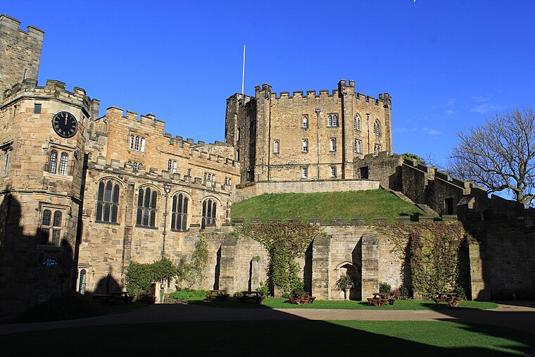
Photo: Carla Brain, CC BY-SA 2.0.
Durham Castle is a Norman castle in the city of Durham, England, which has been occupied since 1837 by University College, Durham after its previous role as the residence of the Bishops of Durham. Durham Castle is situated 1¼ miles northwest of The Blacker Bombard.
Places in the Area
Nearby places include Shincliffe and Old Durham.
Shincliffe
Village

Photo: Russel Wills, CC BY-SA 2.0.
Shincliffe is a village and civil parish in County Durham, England. The parish population was 1,796. It is situated just over 1 mile to the south-east of Durham city centre, on the A177 road to Stockton.
Old Durham
Hamlet

Photo: Roger Smith, CC BY-SA 2.0.
Old Durham is a hamlet in County Durham, in England. It is situated approximately 1 mile east of central Durham and south of Gilesgate. The most northerly remains of a Romanised farmstead in the Roman Empire were excavated at Old Durham during 1940s.
Houghall
Hamlet
 Houghall is a hamlet in County Durham, in England. It is situated approximately 1.5 miles to the south of Durham city centre. It is also the location of the Houghall Campus of East Durham College, associated gardens, a small number of houses and a restaurant.
The Blacker Bombard
- Type: Sign
- Categories: information and tourism
- Location: Shincliffe, County Durham, North East England, England, United Kingdom, Britain and Ireland, Europe
- View on OpenStreetMap
Latitude
54.76394° or 54° 45′ 50″ northLongitude
-1.55485° or 1° 33′ 17″ westOpen location code
9C6WQC7W+H3OpenStreetMap ID
node 13431002842OpenStreetMap feature
tourism=information
This page is based on OpenStreetMap, Wikidata, and Wikimedia Commons.
We’d love your help improving our open data sources. Thank you for contributing.
Satellite Map
Discover The Blacker Bombard from above in high-definition satellite imagery.
Notable Places Nearby
Highlights include Rubber Crumb 2 (3G2) and Houghall Plant Centre.
Nearby Places
Explore places such as Rosetree Inn (gas installation) and 1. Shincliffe Bridge Wood.
County Durham: Must-Visit Destinations
Delve into Durham, Darlington, Hartlepool, and Stockton-on-Tees.
Curious Places to Discover
Uncover intriguing places from every corner of the globe.
About Mapcarta. Data © OpenStreetMap contributors and available under the Open Database License". Text is available under the CC BY-SA 4.0 license, except for photos, directions, and the map. Photo: Roberto Strauss, CC BY 2.0.