Düzgün Baba
Düzgün Baba is a kiosk in Remagen, Bad Neuenahr-Ahrweiler, Rhineland-Palatinate. Düzgün Baba is situated nearby to the community center Jugendbahnhof Remagen, as well as near the railway station Remagen station.| Tap on a place to explore it |
Places of Interest Nearby
Highlights include Remagen station and Martinsbrunnen.
Remagen station
Railway station
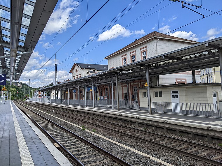
Photo: Tohma, CC BY-SA 4.0.
Remagen station is on the Left Rhine line in the city of Remagen in the German state of Rhineland-Palatinate. It is classified by Deutsche Bahn as a category 4 station.

Marienbrunnen
Fountain

Photo: Gerd Fahrenhorst, CC BY 4.0.
Marienbrunnen is a fountain, which is situated 220 metres northwest of Düzgün Baba.
Places in the Area
Nearby places include Erpel and Orsberg.
Erpel
Village

Photo: Steffen 962, CC BY-SA 4.0.
Erpel is a municipality in the district of Neuwied, in Rhineland-Palatinate, Germany.


Düzgün Baba
- Type: Kiosk
- Wheelchair access: yes
- Category: shop
- Location: Remagen, Bad Neuenahr-Ahrweiler, Eifel, Rhineland-Palatinate, Germany, Central Europe, Europe
- View on OpenStreetMap
Latitude
50.57744° or 50° 34′ 39″ northLongitude
7.23007° or 7° 13′ 48″ eastOpen location code
9F29H6GJ+X2OpenStreetMap ID
node 1371606316OpenStreetMap feature
shop=kioskOpenStreetMap attribute
wheelchair=yes
This page is based on OpenStreetMap, Wikidata, and Wikimedia Commons.
We’d love your help improving our open data sources. Thank you for contributing.
Satellite Map
Discover Düzgün Baba from above in high-definition satellite imagery.
Notable Places Nearby
Highlights include Jugendbahnhof Remagen and Maisons-Laffitte-Platz.
Nearby Places
Explore places such as Transdev and Dr. Jürgen Lenk Praxis für Allgemeinmedizin.
Eifel: Must-Visit Destinations
Delve into Bitburg, Mayen, Nürburg, and Dernau.
Curious Kiosks to Discover
Uncover intriguing kiosks from every corner of the globe.
About Mapcarta. Data © OpenStreetMap contributors and available under the Open Database License". Text is available under the CC BY-SA 4.0 license, except for photos, directions, and the map. Photo: Thilver, CC BY-SA 4.0.