Lower Earley Map
Lower Earley Map is in Earley, Wokingham, England. Lower Earley Map is situated nearby to the playground Carnival Field, as well as near the recreation area Earley Event Field.| Tap on a place to explore it |
Places of Interest Nearby
Highlights include Maiden Erlegh Lakes and St Nicolas Church.
Maiden Erlegh Lakes
Nature reserve
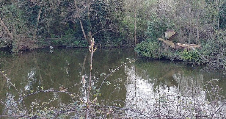
Photo: Babylon77, CC BY-SA 4.0.
Maiden Erlegh Lakes is a 10.2-hectare Local Nature Reserve Earley, a suburb of Reading in Berkshire. It is owned and managed by Earley Town Council.
St Nicolas Church
Church

Photo: Michael FORD, CC BY-SA 2.0.
St Nicolas Church is situated 3,300 feet north of Lower Earley Map.
Earley railway station
Railway station
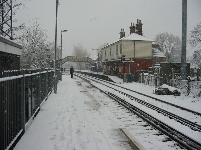
Photo: Rob Motha, CC BY-SA 2.0.
Earley railway station serves the Berkshire town of Earley, England. It is 66 miles 1 chain down the line from London Charing Cross via Redhill. It is on the Waterloo to Reading Line, and forms the last stop before the terminus of the line at Reading. Earley railway station is situated 1 mile north of Lower Earley Map.
Places in the Area
Nearby places include Lower Earley and Earley.
Lower Earley
Suburb

Photo: Rosalind Mitchell, CC BY-SA 2.0.
Lower Earley is a suburb of Earley, a town in Berkshire, England. Lower Earley is a predominantly lower-density residential area lying on the northern banks of the River Loddon.
Earley
Suburb

Photo: Virginia Knight, CC BY-SA 2.0.
Earley is a town and civil parish in the Borough of Wokingham, Berkshire, England. Along with the neighbouring town of Woodley, the Office for National Statistics places Earley within the Reading/Wokingham Urban Area; for the purposes of local government it falls within the Borough of Wokingham, outside the area of Reading Borough Council.
Sindlesham
Village
 Sindlesham is an estate village in the borough of Wokingham in Berkshire, England. It is located around 4 miles southeast of Reading and around 6 miles west of the town of Bracknell, and just south of the village of Winnersh, from which it is separated by the M4 motorway.
Lower Earley Map
- Type: Map
- Categories: information and tourism
- Location: Earley, Wokingham, England, United Kingdom, Britain and Ireland, Europe
- View on OpenStreetMap
Latitude
51.42843° or 51° 25′ 42″ northLongitude
-0.91396° or 0° 54′ 50″ westOpen location code
9C3XC3HP+9COpenStreetMap ID
node 1394136747OpenStreetMap feature
tourism=information
This page is based on OpenStreetMap, Wikidata, and Wikimedia Commons.
We’d love your help improving our open data sources. Thank you for contributing.
Satellite Map
Discover Lower Earley Map from above in high-definition satellite imagery.
Notable Places Nearby
Highlights include Carnival Field and Earley Event Field.
Nearby Places
Explore places such as Sainsbury’s Local and WHSmith.
England: Must-Visit Destinations
Delve into London, Manchester, Sheffield, and Leeds.
Curious Places to Discover
Uncover intriguing places from every corner of the globe.
About Mapcarta. Data © OpenStreetMap contributors and available under the Open Database License". Text is available under the CC BY-SA 4.0 license, except for photos, directions, and the map. Photo: sidibousaid, CC BY 2.0.