Kuhleger Hütt - Baita Kuhleger
Kuhleger Hütt - Baita Kuhleger is a shelter in Cortaccia sulla strada del vino/Kurtatsch an der Weinstraße, South Tyrol, Trentino-Alto Adige. Kuhleger Hütt - Baita Kuhleger is situated nearby to the nature reserve Pflanzenschutzgebiet Schönleiten - Zona di flora protetta Schönleiten, as well as near the peak Battaillonskopf - Cima Battaglione.| Tap on a place to explore it |
Places of Interest Nearby
Highlights include Roen and St. Cyricus and Julitta.
Roen
Scenic viewpoint

Photo: Wikimedia, Public domain.
The Roen is a mountain of the Nonsberg group on the border between South Tyrol and Trentino, Italy. Roen is situated 3½ km north of Kuhleger Hütt - Baita Kuhleger.
St. Cyricus and Julitta
Church

Photo: SMLW, CC BY-SA 3.0.
St. Cyricus and Julitta is a church, which is situated 3½ km east of Kuhleger Hütt - Baita Kuhleger.
St. James’s Church, Kastelaz
Church

Photo: Beckstet, CC BY-SA 3.0.
St. James's Church is a church on the Kastelaz hill in Tramin an der Weinstraße, South Tyrol, which is known foremost for its Romanesque frescos. The church is sometimes mistakenly called St. St. James’s Church, Kastelaz is situated 4 km northeast of Kuhleger Hütt - Baita Kuhleger.
Places in the Area
Nearby places include Kurtatsch an der Weinstraße and Tramin an der Weinstraße.
Kurtatsch an der Weinstraße
Village
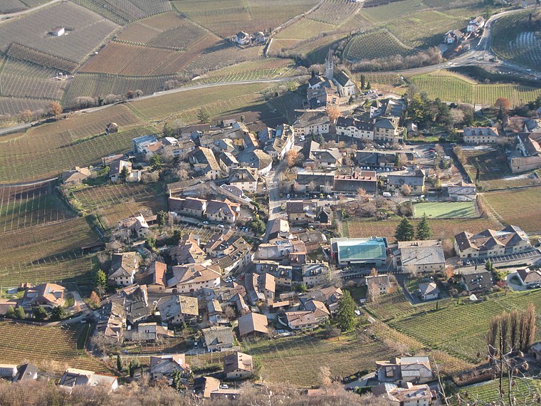 Kurtatsch an der Weinstraße, often abbreviated to Kurtatsch or Cortaccia, is a comune and a village in South Tyrol in northern Italy, located about 25 kilometres southwest of the city of Bolzano. Kurtatsch an der Weinstraße is situated 3 km southeast of Kuhleger Hütt - Baita Kuhleger.
Tramin an der Weinstraße
Village

Photo: Rufus46, CC BY-SA 3.0.
Tramin an der Weinstraße, often abbreviated to Tramin or Termeno, is a comune in South Tyrol, northern Italy, located about 20 kilometres southwest of the city of Bolzano. The name of the grape variety Gewürztraminer has its origins in Tramin. Tramin an der Weinstraße is situated 4 km east of Kuhleger Hütt - Baita Kuhleger.
Margreid an der Weinstraße
Village
Margreid an der Weinstraße, often abbreviated to Margreid or Magrè, is a comune and a village in South Tyrol in northern Italy, located about 25 kilometres southwest of the city of Bolzano. Margreid an der Weinstraße is situated 5 km south of Kuhleger Hütt - Baita Kuhleger.
Kuhleger Hütt - Baita Kuhleger
Latitude
46.33058° or 46° 19′ 50″ northLongitude
11.19542° or 11° 11′ 44″ eastOpen location code
8FRH85JW+65OpenStreetMap ID
node 1421210767OpenStreetMap feature
amenity=shelter
This page is based on OpenStreetMap, Wikidata, and Wikimedia Commons.
We’d love your help improving our open data sources. Thank you for contributing.
Satellite Map
Discover Kuhleger Hütt - Baita Kuhleger from above in high-definition satellite imagery.
In Other Languages
From German to Italian—“Kuhleger Hütt - Baita Kuhleger” goes by many names.
- German: “Kuhleger Hütt”
- Italian: “Baita Kuhleger”
Notable Places Nearby
Highlights include Pflanzenschutzgebiet Schönleiten - Zona di flora protetta Schönleiten and Battaillonskopf - Cima Battaglione.
Nearby Places
Explore places such as Malga Vecchia di Coredo and Thurner.
South Tyrol: Must-Visit Destinations
Delve into Bolzano, Brixen, Merano, and Bruneck.
Curious Shelters to Discover
Uncover intriguing shelters from every corner of the globe.
About Mapcarta. Data © OpenStreetMap contributors and available under the Open Database License". Text is available under the CC BY-SA 4.0 license, except for photos, directions, and the map. Photo: Benreis, CC BY 3.0.