Créteil Marée
Créteil Marée is a seafood market in Créteil, Val-de-Marne, Île-de-France. Créteil Marée is situated nearby to Place Henri Dunant, as well as near the town hall Relais-mairie Henri Dunant.| Tap on a place to explore it |
Places of Interest Nearby
Highlights include Halle de Créteil and Saint-Christophe Church, Créteil.
Halle de Créteil
Marketplace

Photo: Chabe01, CC BY-SA 4.0.
Halle de Créteil is a marketplace, which is situated 200 metres east of Créteil Marée.
Saint-Christophe Church, Créteil
Church

Photo: Chabe01, CC BY-SA 4.0.
Saint-Christophe Church is a Catholic church located in Créteil. It is dedicated to Saint Christopher. Saint-Christophe Church, Créteil is situated 190 metres northwest of Créteil Marée.
Salle des fêtes Jean-Cocteau
Community center

Photo: Chabe01, CC BY-SA 4.0.
Salle des fêtes Jean-Cocteau is a community center, which is situated 230 metres east of Créteil Marée.
Places in the Area
Nearby places include Créteil and Saint-Maur-des-Fossés.
Créteil
Town

Photo: Paul Fleury, CC BY 3.0.
Créteil is a commune in the southeastern suburbs of Paris, Île-de-France. It is located 11.7 km from the centre of Paris. Créteil is the préfecture of the Val-de-Marne department as well as the seat of the Arrondissement of Créteil.
Saint-Maur-des-Fossés
Town

Photo: Chabe01, CC BY-SA 4.0.
Saint-Maur-des-Fossés is a commune in Val-de-Marne, the southeastern suburbs of Paris, France, 11.7 kilometres from the centre of Paris.
Maisons-Alfort
Town
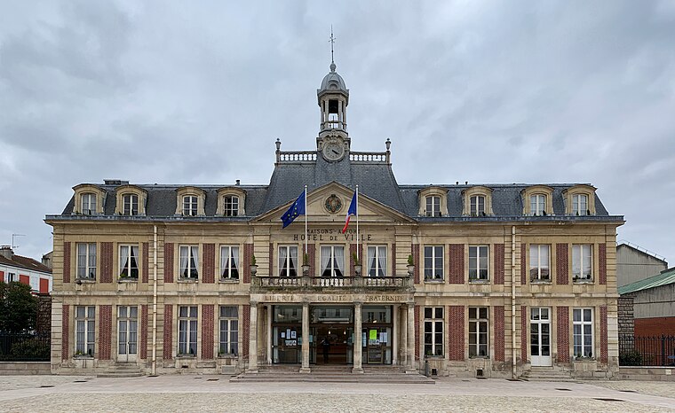
Photo: Chabe01, CC BY-SA 4.0.
Maisons-Alfort is a commune in the southeastern suburbs of Paris, France. It is located 8.4 km from the center of Paris. Maisons-Alfort is famous as the location of the National Veterinary School of Alfort. Maisons-Alfort is situated 2½ km west of Créteil Marée.
Créteil Marée
- Opening hours:
Wednesday—Friday: 8:30 AM—12:30 PM and 4:00 PM—7:30 PM
Saturday: 8:00 AM—8:00 PM
Sunday: 8:00 AM—1:00 PM - Type: Seafood market
- Categories: shop and food
- Location: Créteil, Arrondissement of Créteil, Val-de-Marne, Île-de-France, France, Europe
- View on OpenStreetMap
Latitude
48.79275° or 48° 47′ 34″ northLongitude
2.4627° or 2° 27′ 46″ eastOpen location code
8FW4QFV7+33OpenStreetMap ID
node 1454697243OpenStreetMap feature
shop=seafood
This page is based on OpenStreetMap, Wikidata, and Wikimedia Commons.
We’d love your help improving our open data sources. Thank you for contributing.
Satellite Map
Discover Créteil Marée from above in high-definition satellite imagery.
Notable Places Nearby
Highlights include Place Henri Dunant and Relais-mairie Henri Dunant.
Nearby Places
Explore places such as Romain Catena and Maison de la Presse.
Île-de-France: Must-Visit Destinations
Delve into Paris, Versailles, Boulogne-Billancourt, and Paris Charles de Gaulle Airport.
Curious Seafood Markets to Discover
Uncover intriguing seafood markets from every corner of the globe.
About Mapcarta. Data © OpenStreetMap contributors and available under the Open Database License". Text is available under the CC BY-SA 4.0 license, except for photos, directions, and the map. Photo: Guillaume Baviere, CC BY 2.0.