La Estación y la Venta
La Estación y la Venta is a locality in Meco, Madrid, Community of Madrid. La Estación y la Venta is situated nearby to the locality El Soto y la Vega, as well as near Vega de la Ermita.| Tap on a place to explore it |
Places of Interest
Highlights include Meco and Church of Nuestra Señora de la Asunción.

Church of Nuestra Señora de la Asunción
Church
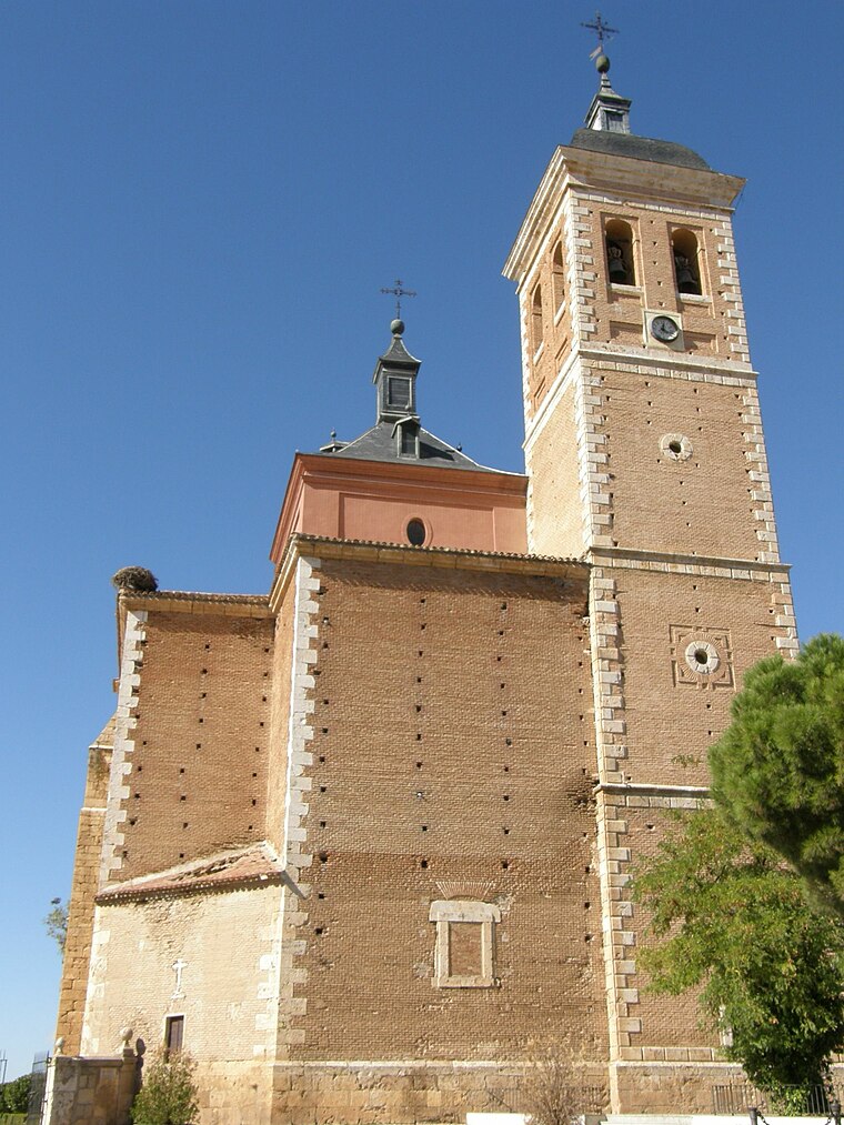
Photo: EventusBonus, CC BY-SA 3.0.
The Church of Nuestra Señora de la Asunción is a church and parish in Meco, Spain. The church was added to the Bien de Interés Cultural registry in 1982. Church of Nuestra Señora de la Asunción is situated 4 km northwest of La Estación y la Venta.
Parroquia Santa Teresa de Jesús
Church

Photo: Oilisab, CC BY-SA 4.0.
Parroquia Santa Teresa de Jesús is a church, which is situated 4 km north of La Estación y la Venta.
Places in the Area
Nearby places include Los Santos de la Humosa and Azuqueca de Henares.
Los Santos de la Humosa
Village

Photo: Wikimedia, CC BY 3.0 es.
Los Santos de la Humosa is a municipality of the Community of Madrid, Spain. Los Santos de la Humosa is situated 4½ km southeast of La Estación y la Venta.
Azuqueca de Henares
Town

Photo: Wikimedia, CC BY-SA 3.0.
Azuqueca de Henares is a municipality located in the province of Guadalajara, Castile-La Mancha, Spain. According to the 2013 census, the municipality had a population of 34,685 inhabitants. The mayor of Azuqueca is José Luis Blanco. Azuqueca de Henares is situated 5 km northeast of La Estación y la Venta.
Ciudad del Aire (Alcalá de Henares)
Neighborhood
 Ciudad del Aire (Alcalá de Henares) is a neighborhood, which is situated 5 km southwest of La Estación y la Venta.
La Estación y la Venta
- Type: Locality
- Location: Meco, Madrid, Community of Madrid, Central Spain, Spain, Iberia, Europe
- View on OpenStreetMap
Latitude
40.52976° or 40° 31′ 47″ northLongitude
-3.2955° or 3° 17′ 44″ westElevation
606 metres (1,988 feet)Open location code
8CGRGPH3+WQOpenStreetMap ID
node 1482407004OpenStreetMap feature
place=locality
This page is based on OpenStreetMap, Wikidata, and Wikimedia Commons.
We’d love your help improving our open data sources. Thank you for contributing.
Satellite Map
Discover La Estación y la Venta from above in high-definition satellite imagery.
Localities in the Area
Explore places such as La Venta and El Soto y la Vega.
Notable Places Nearby
Highlights include Campo de radiación gamma de El Encín and Capilla de El Encín.
Community of Madrid: Must-Visit Destinations
Delve into Madrid, Alcalá de Henares, Getafe, and Aranjuez.
Curious Localities to Discover
Uncover intriguing localities from every corner of the globe.
About Mapcarta. Data © OpenStreetMap contributors and available under the Open Database License". Text is available under the CC BY-SA 4.0 license, except for photos, directions, and the map. Photo: Wikimedia, CC0.