Quarry Ruins
Quarry Ruins is a ruins in Worth Matravers, Purbeck District, England. Quarry Ruins is situated nearby to Radar Research Memorial, as well as near the church St. Aldhelm’s Chapel.| Tap on a place to explore it |
Places of Interest Nearby
Highlights include St. Aldhelm’s Chapel and Radar Research Memorial.
St. Aldhelm’s Chapel
Church

Photo: Wulfrunian1, CC BY-SA 3.0.
St Aldhelm's Chapel is a Norman chapel on St Aldhelm's Head in the parish of Worth Matravers, Swanage, Dorset. It stands close to the cliffs, 108 metres above sea level. St. Aldhelm’s Chapel is situated 660 feet northwest of Quarry Ruins.
Radar Research Memorial
Memorial

Photo: Phil Champion, CC BY-SA 2.0.
Radar Research Memorial is situated 370 feet west of Quarry Ruins.
Encombe House
Manor estate

Photo: Mike Searle, CC BY-SA 2.0.
Encombe House is a privately owned, Grade II* listed country house built in 1735 on the Encombe Estate near the village of Kingston and about 1-mile inland of Dorset's Jurassic Coast in southern England. Encombe House is situated 2 miles northwest of Quarry Ruins.
Places in the Area
Nearby places include Winspit and Worth Matravers.
Winspit
Locality

Photo: Charlesdrakew, Public domain.
Winspit is a disused quarry on the cliffs near Worth Matravers in the Isle of Purbeck, Dorset, England. To the west and east are the hills of West Man and East Man.
Worth Matravers
Village
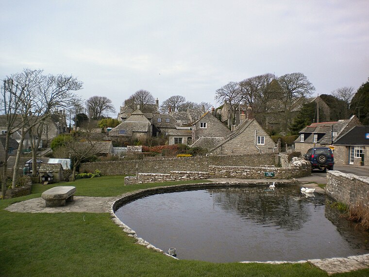
Photo: Charlesdrakew, Public domain.
Worth Matravers is a village and civil parish in the English county of Dorset. The village is situated on the cliffs west of Swanage. It comprises limestone cottages and farm houses and is built around a pond, which is a regular feature on postcards of the Isle of Purbeck.
Acton
Hamlet

Photo: Huligan0, CC BY-SA 3.0.
Acton is a hamlet in the parish of Langton Matravers, on the Isle of Purbeck, in the county of Dorset in the south of England. Acton was built as living quarters for the quarrymen working at the local quarries. Acton is situated 2½ miles northeast of Quarry Ruins.
Quarry Ruins
- Type: Ruins
- Category: historic site
- Location: Worth Matravers, Purbeck District, Dorset, West Country, England, United Kingdom, Britain and Ireland, Europe
- View on OpenStreetMap
Latitude
50.5788° or 50° 34′ 44″ northLongitude
-2.05437° or 2° 3′ 16″ westOpen location code
9C2VHWHW+G7OpenStreetMap ID
node 1485839934OpenStreetMap feature
historic=ruins
This page is based on OpenStreetMap, Wikidata, and Wikimedia Commons.
We’d love your help improving our open data sources. Thank you for contributing.
Satellite Map
Discover Quarry Ruins from above in high-definition satellite imagery.
Places with the Same Name
Discover other places named “Quarry Ruins”.
Notable Places Nearby
Highlights include Tumulus and West Man.
Nearby Places
Explore places such as Coastwatch Lookout Station and Bonvils Farm.
Dorset: Must-Visit Destinations
Delve into Bournemouth, Poole, Dorchester, and Weymouth.
Curious Ruins to Discover
Uncover intriguing ruins from every corner of the globe.
About Mapcarta. Data © OpenStreetMap contributors and available under the Open Database License". Text is available under the CC BY-SA 4.0 license, except for photos, directions, and the map. Photo: Diliff, CC BY-SA 3.0.