Wax
Wax is a bar in Nottingham, England which is located on Broad Street. Wax is situated nearby to the theater building Nottingham Arts Theatre, as well as near Clumber Hall Evangelical Church.| Tap on a place to explore it |
Places of Interest Nearby
Highlights include Nottingham Arts Theatre and Broadway Cinema.
Nottingham Arts Theatre
Theater building

Photo: David Hallam-Jones, CC BY-SA 2.0.
Nottingham Arts Theatre is a theatre on George Street in Nottingham, England. Formerly known as the Co-op Arts Theatre, it is located in the former George Street Particular Baptist Church building.
Broadway Cinema
Movie theater
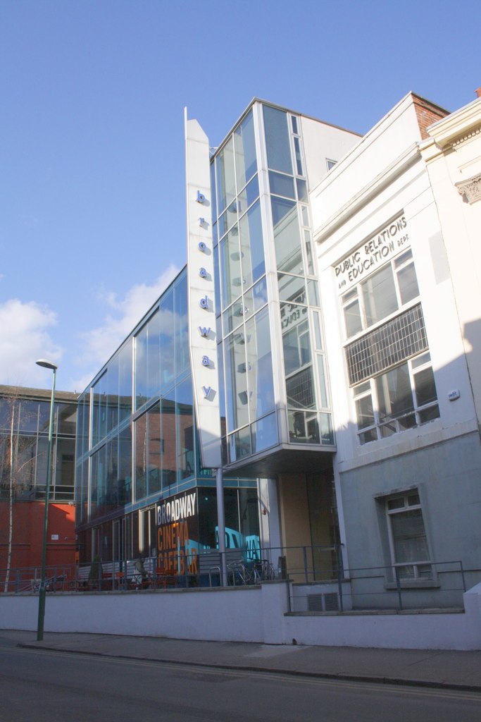
Photo: Roger Templeman, CC BY-SA 2.0.
Broadway Cinema is an independent cinema in the city of Nottingham, England in the United Kingdom. It is located in the Hockley area. In 2009, it was rated as one of the best cinemas in the world by Total Film magazine.
Parliament Street Methodist Church
Church

Photo: Andrew Abbott, CC BY-SA 2.0.
Parliament Street Methodist Church is a Methodist church on Parliament Street in Nottingham.
Places in the Area
Nearby places include Hockley and Lace Market.
Hockley
Neighborhood

Photo: Alan Murray-Rust, CC BY-SA 2.0.
Hockley is an area near the city centre of Nottingham, England. It lies adjacent to the Lace Market area and contains multiple well-preserved Victorian buildings.
Lace Market
Neighborhood

Photo: Alan Murray-Rust, CC BY-SA 2.0.
The Lace Market is a historic quarter-mile square area in the centre of Nottingham, England. It was once the centre of the world's lace industry and was an area of salesrooms and warehouses for storing, displaying and selling the lace.
St Ann’s
Suburb

Photo: ClemRutter, CC BY-SA 3.0.
St Ann's is a large district of the city of Nottingham, in the English ceremonial county of Nottinghamshire. The population of the district at the time of the United Kingdom census, 2011 was 19,316.
Wax
- Type: Bar
- Address: 27 Broad Street, Nottingham, NG1 3AP
- Category: building
- Location: Nottingham, England, United Kingdom, Britain and Ireland, Europe
- View on OpenStreetMap
Latitude
52.95467° or 52° 57′ 17″ northLongitude
-1.14455° or 1° 8′ 40″ westOpen location code
9C4WXV34+V5OpenStreetMap ID
node 1507335991OpenStreetMap feature
amenity=barOpenStreetMap feature
building=vacant
This page is based on OpenStreetMap, Wikidata, and Wikimedia Commons.
We’d love your help improving our open data sources. Thank you for contributing.
Satellite Map
Discover Wax from above in high-definition satellite imagery.
Places with the Same Name
Discover other places named “Wax”.
Notable Places Nearby
Highlights include Clumber Hall Evangelical Church and Gloryholes.
Nearby Places
Explore places such as Castle Exchange and Lord Roberts.
England: Must-Visit Destinations
Delve into London, Manchester, Sheffield, and Leeds.
Curious Bars to Discover
Uncover intriguing bars from every corner of the globe.
About Mapcarta. Data © OpenStreetMap contributors and available under the Open Database License". Text is available under the CC BY-SA 4.0 license, except for photos, directions, and the map. Photo: sidibousaid, CC BY 2.0.