Liceo Mixto Malhabar
Liceo Mixto Malhabar is a school in Villamaría, Caldas Department. Liceo Mixto Malhabar is situated nearby to Ares boscosa Urbana, as well as near the pitch Cancha Múltiple.| Tap on a place to explore it |
Places of Interest Nearby
Highlights include Estadio Palogrande and Torre de Herveo.
Estadio Palogrande
Stadium

Photo: Wikimedia, CC BY-SA 4.0.
Estadio Palogrande is a multi-purpose stadium in Manizales, Colombia with a capacity of 31,611. It is currently used mostly for football matches as home venue of the Once Caldas, winners of the 2004 Copa Libertadores. Estadio Palogrande is situated 2 km northeast of Liceo Mixto Malhabar.
Torre de Herveo
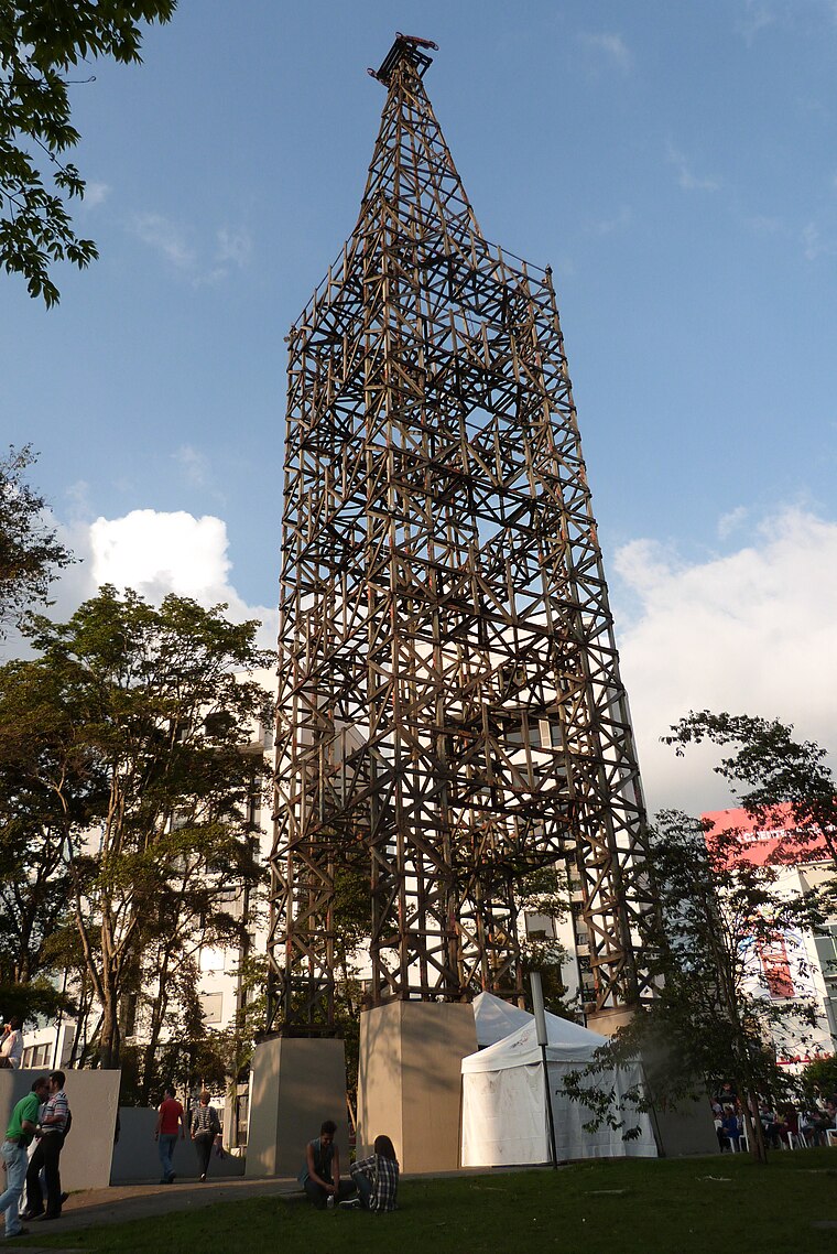
Photo: Brenda Berrio Aagudelo, CC BY-SA 3.0.
Torre de Herveo, also known as Torre del Cable, is a wooden Colombian lattice tower which was the tallest of the support towers of the Manizales - Mariquita Cableway. Torre de Herveo is situated 2 km northeast of Liceo Mixto Malhabar.
Cathedral Basilica of Our Lady of the Rosary, Manizales
Church

Photo: Pablo toro, CC BY-SA 3.0.
The Cathedral Basilica of Our Lady of the Rosary, also called Manizales Cathedral, is a Catholic cathedral, located directly opposite the Plaza de Bolivar in the city of Manizales, Colombia. Cathedral Basilica of Our Lady of the Rosary, Manizales is situated 3 km northwest of Liceo Mixto Malhabar.
Places in the Area
Nearby places include Manizales.
Manizales

Photo: Wikimedia, CC BY-SA 3.0.
Manizales is the capital of the Department of Caldas in Colombia's Zona Cafetera. The city has a real European, small city feel to it, like being in Switzerland or the Alps.
Liceo Mixto Malhabar
- Type: School
- Category: education
- Location: Villamaría, Caldas Department, Colombia, South America
- View on OpenStreetMap
Latitude
5.04574° or 5° 2′ 45″ northLongitude
-75.50215° or 75° 30′ 8″ westOpen location code
67Q62FWX+74OpenStreetMap ID
node 1660843430OpenStreetMap feature
amenity=school
This page is based on OpenStreetMap, Wikidata, and Wikimedia Commons.
We’d love your help improving our open data sources. Thank you for contributing.
Satellite Map
Discover Liceo Mixto Malhabar from above in high-definition satellite imagery.
Notable Places Nearby
Highlights include Ares boscosa Urbana and Cancha Múltiple.
Nearby Places
Explore places such as Casa de la cultura and Papipán.
Colombia: Must-Visit Destinations
Delve into Bogotá, Medellín, Cali, and Cartagena.
Curious Schools to Discover
Uncover intriguing schools from every corner of the globe.
About Mapcarta. Data © OpenStreetMap contributors and available under the Open Database License". Text is available under the CC BY-SA 4.0 license, except for photos, directions, and the map. Photo: jhoudayer, CC BY-SA 2.0.