Mückenkopp
Mückenkopp is a peak in Lorch am Rhein, Rheingau-Taunus-Kreis, Hesse and has an elevation of 274 metres. Mückenkopp is situated nearby to the village Ranselberg, as well as near the locality Wachtenberg.| Tap on a place to explore it |
Places of Interest
Highlights include Fürstenberg Castle and Heimburg in Niederheimbach.
Fürstenberg Castle
Castle

Photo: Peter Weller, CC BY-SA 3.0.
The Burg Fürstenberg is a castle in the municipality of Oberdiebach in Rhineland-Palatinate, Germany. When the castle was built, in 1219, this part of the small Oberdiebach was the village of Rheindiebach.
Heimburg in Niederheimbach
Castle
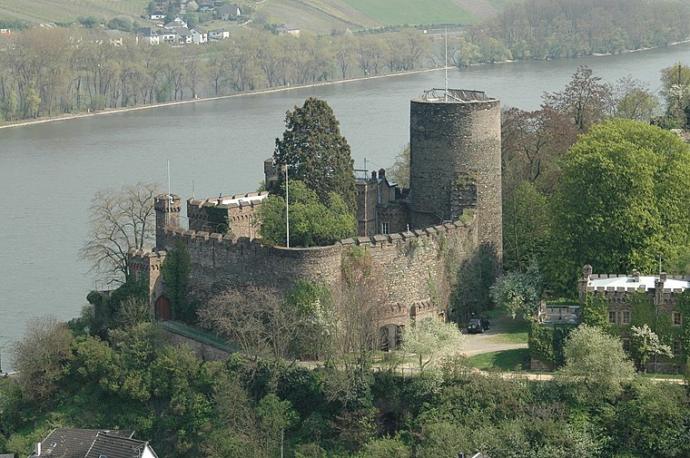
Photo: Peter Weller, CC BY-SA 3.0.
The Heimburg is a castle in the village of Niederheimbach in Rhineland-Palatinate, Germany.
Ruine Nollig
Castle

Photo: Johannes Robalotoff, CC BY-SA 3.0 de.
Nollig Castle is a ruin above the village of Lorch in Hesse, Germany.
Places in the Area
Nearby places include Bacharach and Kaub.
Bacharach

Photo: Pedelecs, CC BY-SA 3.0.
Bacharach is a town in the Mainz-Bingen district in Rhineland-Palatinate, Germany. It belongs to the Verbandsgemeinde of Rhein-Nahe, whose seat is in Bingen am Rhein, although that town is not within its bounds.
Kaub

Photo: Traveler100, CC BY-SA 3.0.
Kaub is a town in Germany, state Rhineland-Palatinate, district Rhein-Lahn-Kreis. It is part of the municipality Loreley. It is located on the right bank of the Rhine, approx.
Trechtingshausen

Photo: Traveler100, CC BY-SA 4.0.
Trechtingshausen is a village in the Middle Rhine Valley in the Rhineland-Palatinate region of Germany.
Mückenkopp
- Type: Peak with an elevation of 274 metres
- Category: landform
- Location: Lorch am Rhein, Rheingau-Taunus-Kreis, South Hesse, Hesse, Germany, Central Europe, Europe
- View on OpenStreetMap
Latitude
50.0569° or 50° 3′ 25″ northLongitude
7.8123° or 7° 48′ 44″ eastElevation
274 metres (899 feet)Open location code
9F293R46+PWOpenStreetMap ID
node 1700073838OpenStreetMap feature
natural=peak
This page is based on OpenStreetMap, Wikidata, and Wikimedia Commons.
We’d love your help improving our open data sources. Thank you for contributing.
Satellite Map
Discover Mückenkopp from above in high-definition satellite imagery.
Localities in the Area
Explore places such as Ranselberg and Wachtenberg.
Notable Places Nearby
Highlights include Nollig bei Lorch and Weiselberg.
South Hesse: Must-Visit Destinations
Delve into Darmstadt, Bensheim, Lorsch, and Heppenheim.
Curious Peaks to Discover
Uncover intriguing peaks from every corner of the globe.
About Mapcarta. Data © OpenStreetMap contributors and available under the Open Database License". Text is available under the CC BY-SA 4.0 license, except for photos, directions, and the map. Photo: Alexander Hoernigk, CC BY 3.0.